Truck Map Online
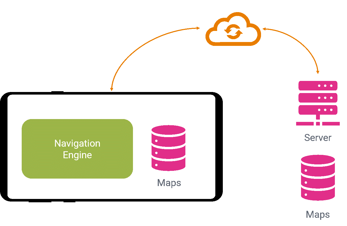
You don’t know whether a online-only truck GPS navigation is the right solution for your telematics application? We have compiled the most important information for you in a decision aid.
You don’t know whether a online-only truck GPS navigation is the right solution for your telematics application? We have compiled the most important information for you in a decision aid.
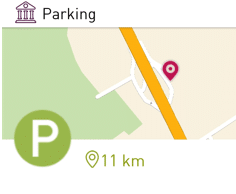
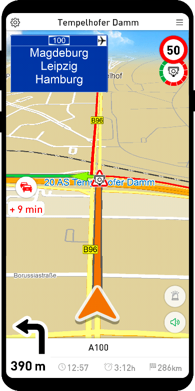
More than 20,000 truck parking options listed in our GPS app — truck GPS navigation and truck parking search all in one app! Find out here how we implement the important topic of parking for truck drivers in MapTrip!
Install the app and start driving immediately! Forget about time-consuming copying of huge road maps and tedious updates. MapTrip Online makes life easier! Learn more here…

New release of truck GPS navigation with truck parking, improved interface and more accurate congestion avoidance.
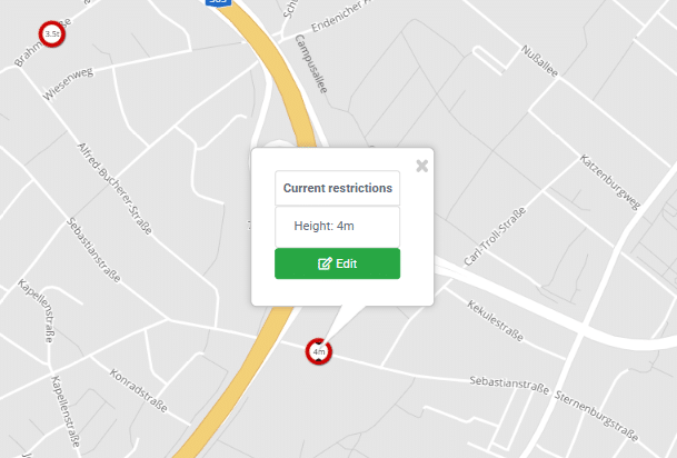
With the Detour Editor you can change truck attributes stored in the map such as clearance height & width yourself and prioritize or avoid roads.

The fire department Wuppertal is using MapTrip 112. Fire chief Dirk Schucka explains the advantages compared to a regular GPS navigation.
The new SDK 9.0 is now available. With our new map data format we can now reduce the map data size significantly. Read the changelog for more improvements.
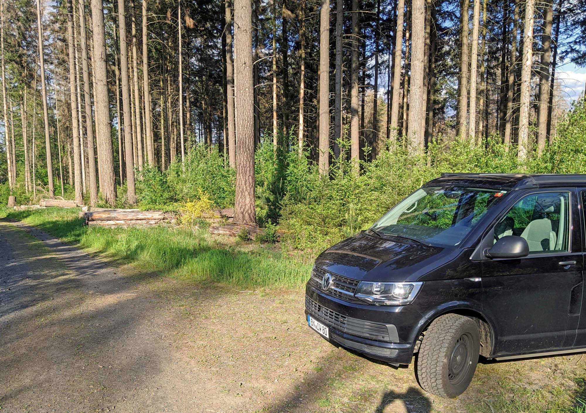
Some navigation destinations are not on public roads but on forest or field paths. Or they are not on any road at all, but in the middle of the terrain. With the navigation app MapTrip FollowMe you can still reach such destinations. How to show how it works.

Send optimized tours from the tour planning directly to the navigation in the garbage truck? Read how we implemented this in successful teamwork between infoware, gts Systems and Consulting gmbH and 3kb GmbH, and how the solution makes everyday work much easier for the drivers and dispatchers of EGN mbh.
You are currently viewing a placeholder content from Facebook. To access the actual content, click the button below. Please note that doing so will share data with third-party providers.
More Information