New Release: Truck GPS SDK
Changelog MapTrip Truck GPS SDK 9.0
We have been working diligently on our further development again and the new Truck GPS SDK 9.0 is now available.
We have listed the main changes in detail here.
Geocoder
Searching for crossing roads is now possible with OSM map data.
Routing
New map data format — reduced size of map data
For the versions from Truck GPS SDK 9.0 we provide a new map data format which brings several advantages.
One of them is the significant reduction in the map data size.
Map size for Europe (example TomTom)
- Now: 5.1GB
- Before: 7.09GB
Improved Offboard Routing with Bad Mobile Coverage
After 3G (UMTS) was switched off, many navigation devices had to use 2G (GPRS) to communicate with the MapTrip routing servers. This sometimes resulted in communication problems between the navigation device and the server. The behavior of the Truck GPS SDK has been improved so that it now reliably falls back on the onboard route calculation with map data stored locally in the navigation device in case of poor reception.
Reference Route: Same map data for the reference route
With the new map data format no separate map sets are required for the reference route.
Reference Route: Improved Accuracy
Improved accuracy of the route on roads with traffic islands.
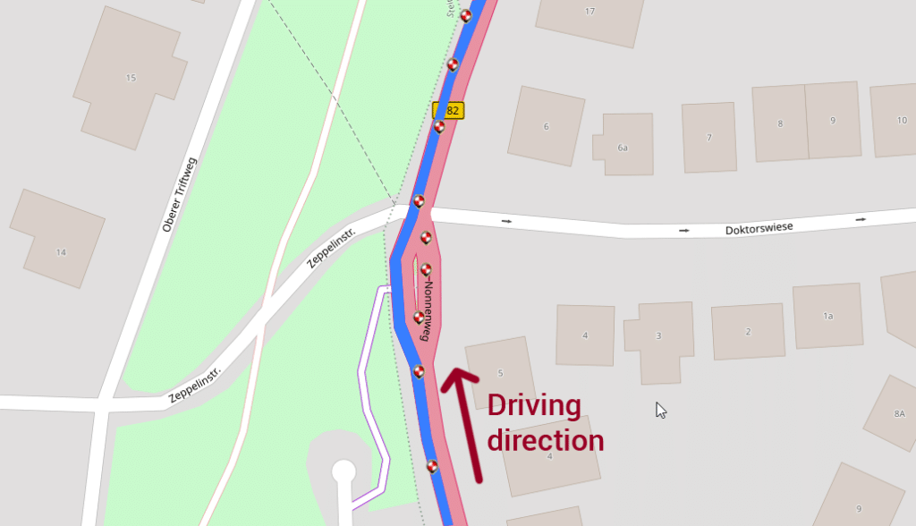
In the example shown, the reference route is to go around the traffic island on the right-hand side (direction of travel is upwards). This works reliably with Truck GPS SDK version 9.0.
Reference Route: Insert a Stop into the Route
In the example shown, a scheduled bus is to follow the reference route shown in blue. The red dots represent the input (points in a CSV file) for creating the reference route. There is a stop at the point marked “Station 9”. It is first passed on the way to the traffic circle without stopping. The bus should then drive through the traffic circle and then stop at station 9.
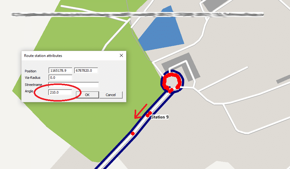
To unambiguously specify whether to stop at the stop on the outbound or return trip, there is a new SDK function:
WayPoint::setDirectionAngle. This can be used to specify the angle at which the (intermediate) destination point should be approached.
Optional: The direction of the reference route is taken into account if settings.ini entry. [ROUTING] SetStationAngleByRefRoute=1 is present. Default is 0.
Statistical Traffic Information
For each route calculation, the parameter MTA_NAV_ROUTE_STAT_DRIVE_TIME_SECONDS_FREE_FLOW provides the statistical travel time without taking into account the current traffic situation and without traffic jams.
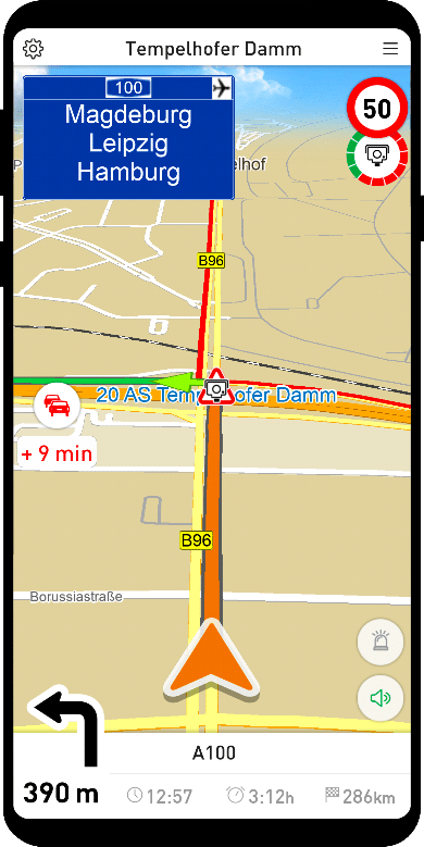
In MapTrip, the difference between statistical travel time and current travel time is displayed on the left side of the screen under the Traffic button. The driver is thus informed how the current travel time differs from the usual travel time at this time of day.
The statistical travel time is calculated by the MapTrip backend considering the statistical traffic data but without taking into account the current traffic situation.
Offboard Route Without Traffic
In the area of rescue, police and firefighting vehicles, there is a requirement NOT to take traffic information into account on the way to the scene of the incident. When driving with blue lights, traffic jams should not be avoided. However, for all other trips, traffic conditions are to be considered in the route selection.
In the offboard route calculation this can now be switched on and off with the functions Navigation::setRouteUseOffboardTraffic and Navigation::getRouteUseOffboardTraffic.
FollowMe
Wrong Way Through Roundabout
To be able to drive in a traffic circle against the driving direction in FollowMe (e.g. in heavy traffic) there is now a new ini parameter [FOLLOWME] AllowUnblockingOfRoundabouts=1. The default is 0.
Suppress Vehicle Restriction Warning
New ini parameter [FOLLOWME] SuppressVehicleRestrictionWarning=1. Normal vehicle warnings are not issued. Disregarded truck attributes are still output. Default is 1.
Improved Memory Management When Recording Very Long FollowMe Routes
New ini parameter [FOLLOWME] MaxPointsInRecordingMapLayer=9999999. With very long FollowMe GPS recordings at some point too many GPS points are displayed in the map. For devices with low memory and performance you can reduce the maximum number of these points with the above parameter. Default setting is 9999999.
Detour & FollowMe
No ini entries (company, username, password and in case of Detour also the detour file) necessary anymore, if the device is known to the MapTrip Manager.
Detour
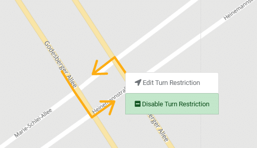
Display Disabled Turn Restrictions
Disabled turning restrictions are shown in MapTrip the same way as in the editor.
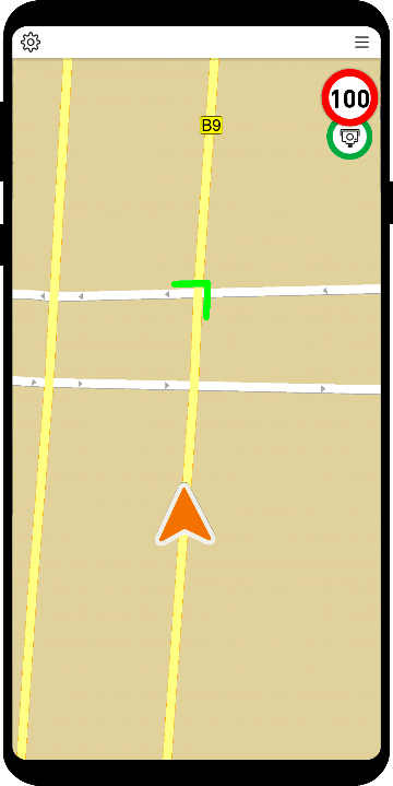
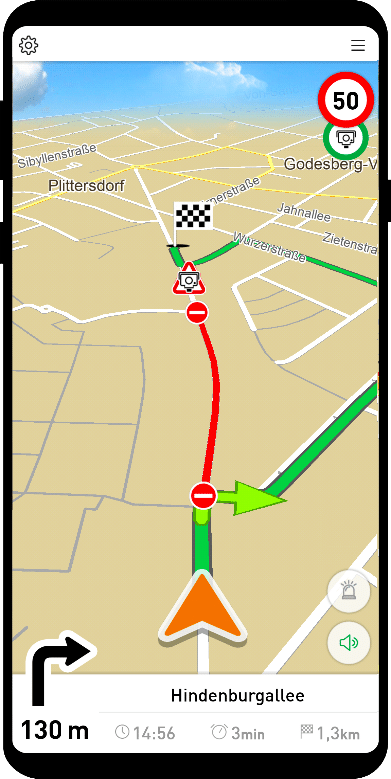
Display of Detour Closures in MapTrip
Display of an icon at the beginning of Detour closures. Closures in both directions have such an icon at both ends accordingly.
Time Domains
Time-recurring closures (time domains) are now supported. Closures can be created with a time period in which they are valid.
New GPS log format MTA_GPS_FILE_TYPE_IWGPS
More compact, but additionally with the horizontal accuracy (Android). This format is better suited to reproduce a supposed SDK error, because it stores all data passed to the SDK by the application using Gps::setPosition. The standard NMEA format does not offer the possibility to store the horizontal accuracy.
MapTrip Remote
New SDK function PostObject::getCreateTime. Returns timestamp when the object was created on the server.