Route Planner App
Individual route planning and GPS navigation
The same applies to route planning as to the tailor-made suit. If you take individual needs into account, you get the better routes (or the nicer suit). Read here how you can customize your route planning and GPS navigation with the Detour Editor.
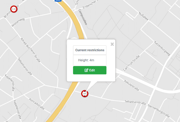
Correct missing or incorrect truck restriction yourself
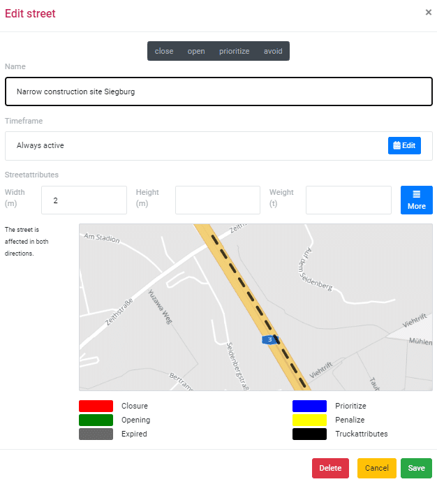
You transport extra-wide cargo and don’t want your drivers to get stuck in a highway construction site? With the Detour Editor, you can add your own truck width blockage at such locations. Existing truck closures can also be edited in the editor. So don’t wait for the next map update, add missing info yourself.
Edit or add truck clearance heights, widths, load and weight limits or tunnel codes with a mouse click.
The routes are different from what you wanted?
No route planning or navigation can completely replace local knowledge. Because even the best maps and the most sophisticated algorithms cannot match the knowledge of an experienced driver or dispatcher acquired over decades. The Detour Editor allows you to use this experience in your individual route planning and GPS navigation.
In route planning and GPS navigation you can
- Add missing truck restrictions (length, width, height, weight, etc.)
- Correct incorrect truck restrictions
- Block/unblock or prioritize/avoid roads
Prioritize or avoid roads
The “Prioritize and Avoid” functions can be used to mark roads that are to be used more or less in the navigation. Prioritized roads then act like a magnet on route planning. Your vehicles will increasingly use these roads instead of alternative routes.
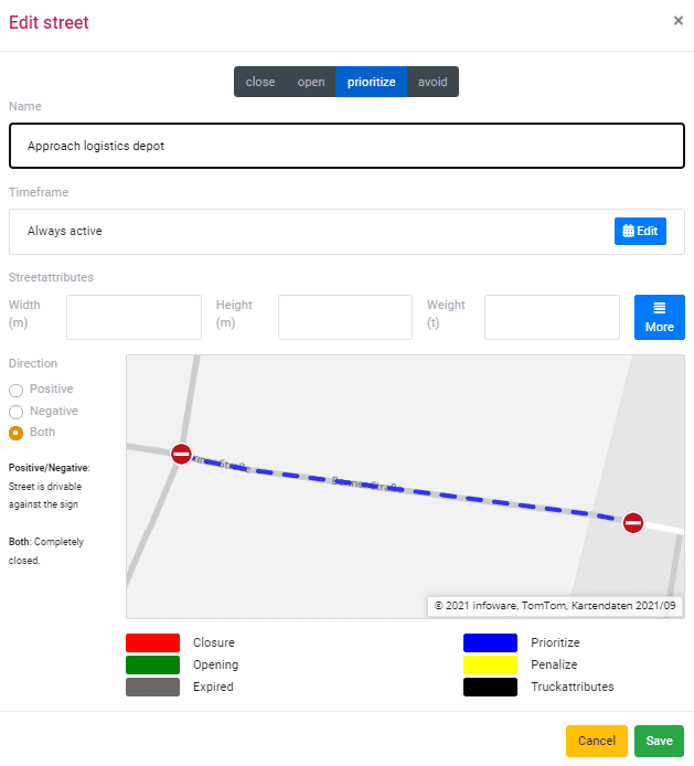
For example, you can define the preferred route from a highway exit to a logistics depot. To do this, you mark the desired route from the freeway to the depot.
A turn-by-turn rule leads to detours?
Turning regulations regulate traffic at intersections and contain prohibited driving maneuvers. Very often, left turns are prohibited in order to avoid intersecting traffic flows. Those who still want to turn left often have to take a detour, which often leads through small side streets.
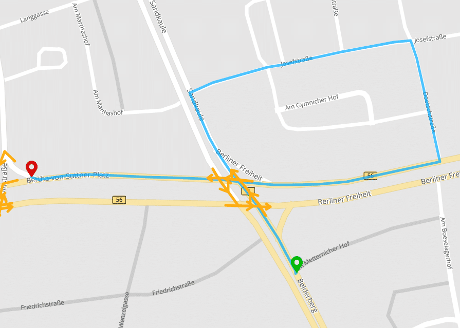
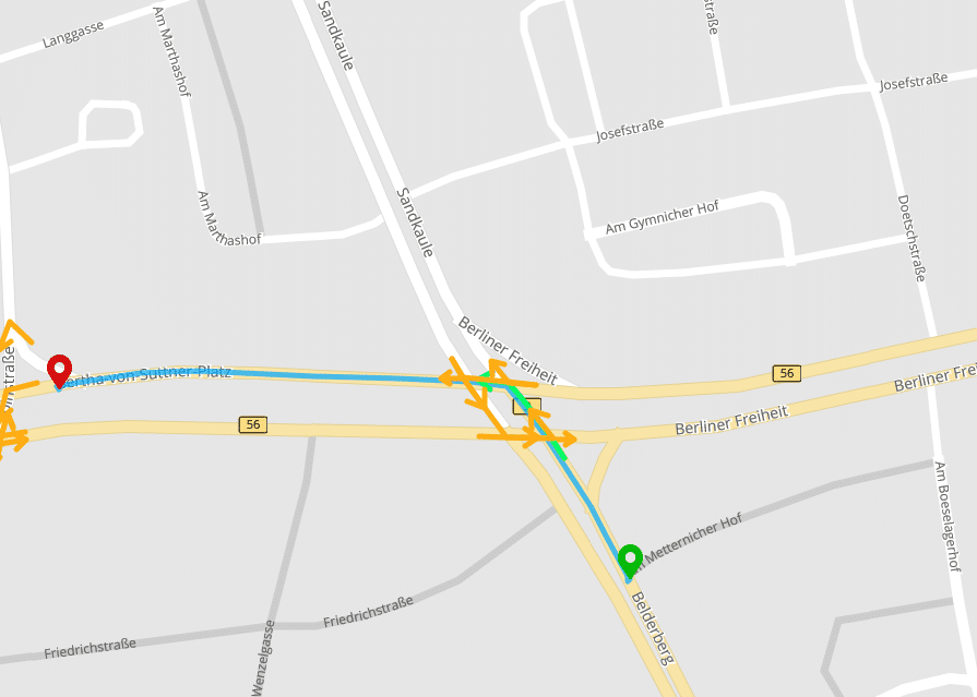
Despite all the perfection of road maps, it unfortunately happens again and again that such seemingly small details are incorrectly recorded in the maps. In the vicinity of our office in Bonn, there is an example of how a turn restriction that does not exist in reality can lead to complicated detours.
Synchronize map edits with the GPS navigation
The entered map improvements are synchronized by the editor directly with your GPS navigation. Your changes are then only visible to your own GPS navigations and of course no one else can change the maps of your GPS navigation.
Identical routes in planning and GPS navigation
The map changes you enter affect route planning and GPS navigation at the same time. No matter whether you made the individual route planning in the Detour Editor, make a route request via the Server API or enter the corresponding destination in GPS Navigation, you will always get the same route!
Developer interface
To ensure that map changes can also be automatically transferred to route planning and GPS navigation, developers can also transfer their changes automatically via the MapTrip Server API. This way, even large numbers of changes can be transferred quickly and regularly from third-party systems.
If you would like to know how to use Detour Editor for your telematics applications, we will be happy to advise you. We are looking forward to your message.
How can I use Detour in my GPS navi and route planning?
The Detour road map editing feature is an add-on function of our navigation software MapTrip. Whether you use MapTrip Truck for logistics, MapTrip 112 for firefighting or the MapTrip Server API, Detour is an optional feature that you can add at any time.