Routing and Scheduling- Route planning interface
and more with the interface of the MapTrip Server-API
If you want to integrate route planning interface, ETA calculations or route optimization into your application, take a look at the MapTrip Server-API . To try it out, get a free demo token here!
Use Cases - Tour Optimization And Much More
You plan tours for your vehicles with 50 stops each? Then you can use the sequence optimization of the Server-API! Via interface you send the coordinates or addresses of the stops to the server. You will get back the optimal order to drive to the stops with minimum time or distance.
You can also take into account time windows, vehicle restrictions by length, height, width, etc., or road closures (see below).
You can then use the routing interface to calculate routes between stops and export them in various formats.
Documentation and Tutorial

You can try out all the functions of the Server-API yourself in the full developer doc here.

Our tutorial explains the basic concepts of the MapTrip Server-API and illustrates them with examples.

On our YouTube channel you will find numerous videos on development topics.

On Github you can find documented code samples to try out.useful hints and examples.
You want to know what MapTrip Server API can do - watch our short video!
You are currently viewing a placeholder content from Youtube. To access the actual content, click the button below. Please note that doing so will share data with third-party providers.
ETA Calculation
For some applications, only the Estimated Time of Arrival (ETA) is required.
Via the interface for route calculation, the start, destination, vehicle type and time / date can be transferred.
The calculation of the trip duration is then performed, as desired, taking into account the current traffic situation, the estimated traffic situation (if a time / date is specified) or using a general traffic situation.
There are also special vehicle profiles for cars, trucks and for blue light journeys.
You have questions about the ETA calculation? Send us a message - we will be happy to advise you.
Route Planning interface
The goal of route planning is to determine a driving distance from a start to a destination as well as the travel time. The MapTrip Server-API can also take into account a variety of parameters to accurately map any application scenario. In response to a routing request, the server provides the exact geometry of the route along with key points such as travel time and length of the route.
You are currently viewing a placeholder content from Youtube. To access the actual content, click the button below. Please note that doing so will share data with third-party providers.
We give an overview of the route calculation interface. In route calculation, there are numerous parameters such as traffic messages, statistical traffic data and vehicle dimensions (length, width, weight, dangerous goods, etc.).
The following parameters, among others, can be taken into account when calculating the route:
- Vehicle type (car, truck)
- Truck attributes (length, width, height, weight, etc.)
- Take live traffic messages into account? Yes/no
- Start time (to consider statistical traffic data)
- Via points (with via points the course of the route can be specified)
- Consider personal changes to road maps (Detour function)
- Calculation with TomTom, Here or OpenStreetMap
The route can be exported as a reference route so that it can be seamlessly reused in MapTrip or in the FollowMe editor.
Capture Road Closures
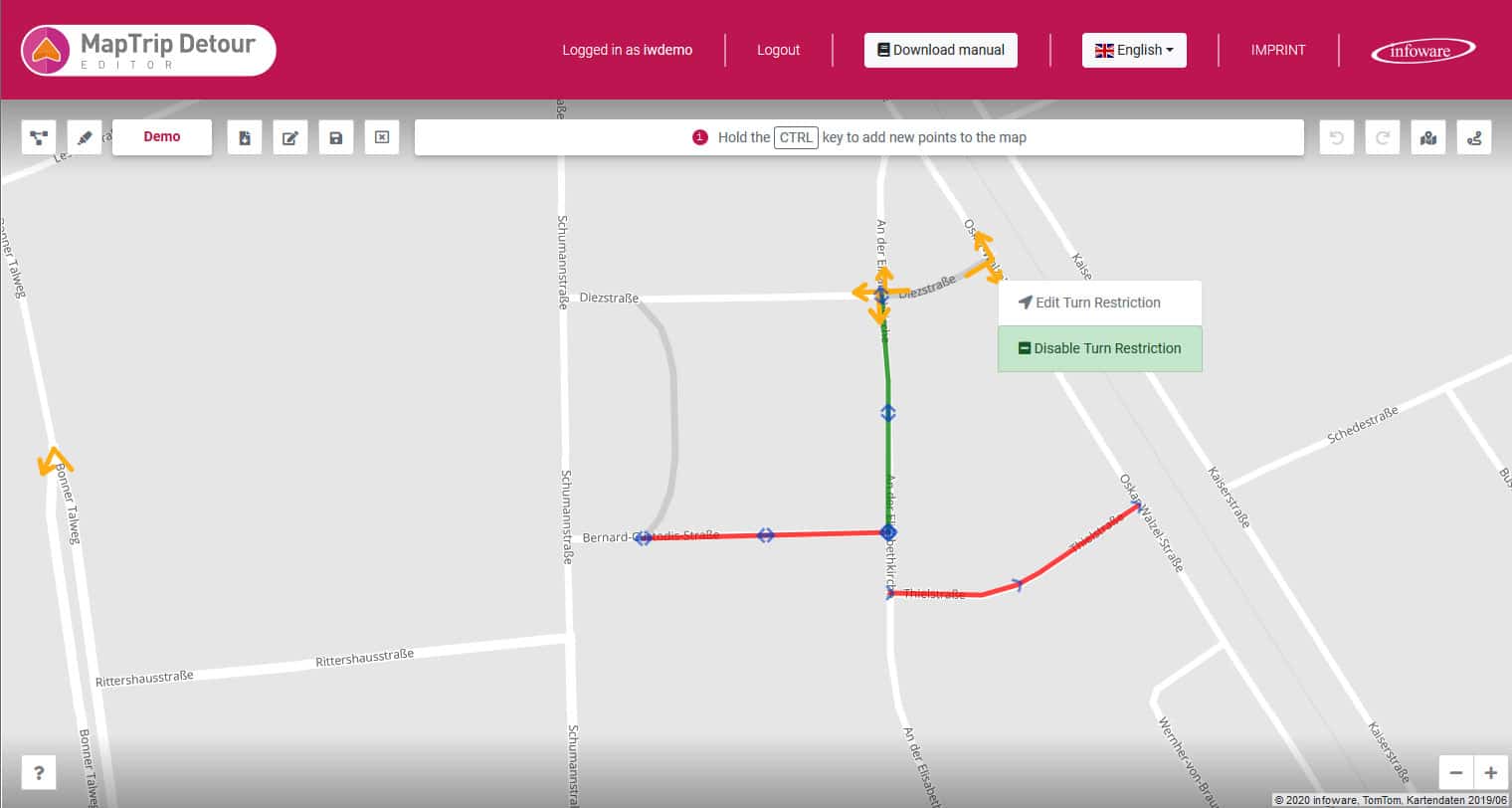
Record road closures, the location of construction sites or simply roads that should not be used by your vehicles. This function is used e.g. by fire departments to prevent emergency vehicles from being led into streets that are not passable.
Using the Server-API, you can select individual road segments or entire road courses by coordinate and block or unblock them.
Define the time from which the blocking / unblocking is valid or define a period of validity.
Your closures are taken into account in route calculations.
You want to know more - write us a message!
You are currently viewing a placeholder content from Youtube. To access the actual content, click the button below. Please note that doing so will share data with third-party providers.
Editing Truck Restrictions
Truck restrictions are stored in the map data of the truck navigation. They contain information such as the height of a tunnel, the maximum weight with which a bridge may be driven on or the width of a road. With the additional function “Detour” you can edit them yourself.
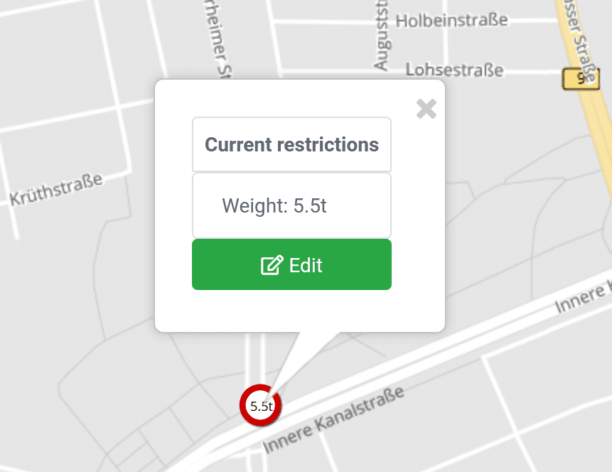
A missing truck restriction, e.g. a low tunnel, can be added in the Detour Editor with a few clicks. Existing truck restrictions can be changed or deleted completely. These functions are interesting for fire departments, for example, who do not have to adhere to the usual traffic rules during emergency trips. But these functions are also useful for other applications, e.g. in heavy goods traffic, e.g. to record the clearance width of a construction site. Truck restrictions can also be captured automatically via the MapTrip Server API.
Personalize Route Calculation
No route planner knows your local environment as well as you do. Even the most up-to-date maps from the most professional providers don't know the potholes you want to avoid or the confusing intersection that always leads to dicey situations. To allow you to tailor the route planning to your exact needs, the Server-API provides functions for preferring and avoiding road sections.
This allows you to mark individual road sections that are preferred for route calculation (and navigation).
Similarly, other routes can be avoided.
The changes you enter are taken into account during route calculation, trip planning and navigation. They are also displayed in the Detour Editor and can be edited.
Want to read more about the Detour Editor and our navigation for police and firefighters?
Seamless Integration With Truck Navigation
The servers behind the API also serve our GPS navigation MapTrip and its editors. The data formats generated by the Server-API can be seamlessly reused in our navigation MapTrip and in our editors. A route calculated with the Server-API can therefore easily be passed directly to MapTrip for navigation, or further processed in one of the editors.
What road maps are available?
You can use the Server-API with road maps from TomTom, Here or OpenStreetMap. You don't have to worry about updates, we do that for you continuously in the background. Depending on your use case, you can choose the best map source. For truck navigation, we recommend TomTom and Here, which have included almost all truck restrictions (e.g. width, height, weight) in their maps. OpenStreetMap on the other hand offers a lot of details and numerous small routes which are partly missing in the other maps.
What traffic information does the Server-API use?
The traffic information comes from TomTom and from Here. Through the Server-API you have access to current traffic messages, the flow speed of traffic on each segment in real time and statistical traffic data.
Try it out - test the MapTrip Server API now
The proof of the pudding is in the eating! We will gladly provide you with a demo account so that you can get an idea of the functions of the MapTrip Server-API yourself. We are also happy to advise you to find the best solution for your use case.
Perfect Trio For Professional Demands
The perfect partners of the Server-API are the MapTrip MapAPI, a JavaScript API that can be 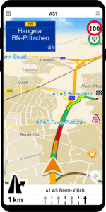
used to develop web applications,and the MapTrip GPS Navigation, which allows you to drive the calculated tours directly.
MapTrip's JavaScript MapAPI is the perfect tool for creating map-based applications. It provides easy communication with the MapTrip app for tracking positions, sending destinations and querying arrival times. In addition, MapAPI provides professional routing and planning features based on the best map and traffic data on the market.
MapTrip is a (truck) navigation software tailored for professional use with the following highlights:
- Best map data from TomTom, Here or OpenStreetMap
- Best and extensive traffic information
- Always on the fastest route
- Exact arrival time calculation
- Simple and intuitive user interface - optimized for truck use
- Truck parking
- Gas stations with fuel prices
- Has interfaces
- Numerous AddOns like:
- Reference route: Often tours are optimized in a complex way. If then only the navigation destination is transferred to the navigation, it calculates the route itself and the optimization results are lost. With the reference route it is possible to drive externally pre-planned routes in their exact course.
- Remote: Remote control of MapTrip via web application, e.g. sending of single navigation destinations or complete routes, retrieval of current navigation parameters up to the course of the current route.
- Detour: Individual blocking or unblocking of roads.
