New Release — Changelog MapTrip 5.6 / SDK 9.6
November 2023
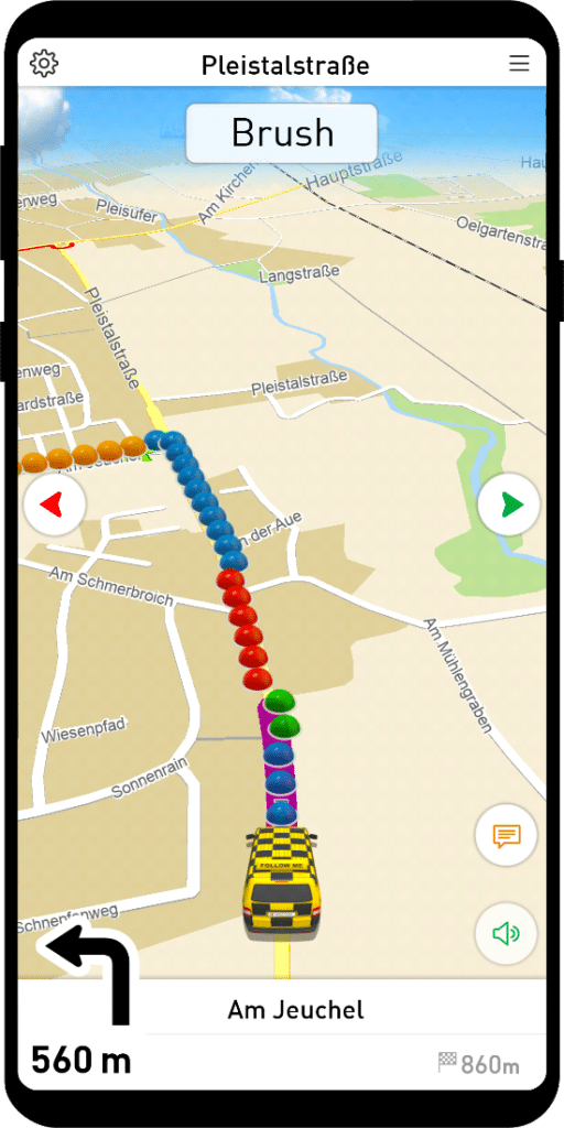
Winter service and street cleaning
FollowMe has been expanded to include additional actions that make it easy for you to tailor the instructions to the specific needs of winter maintenance and street cleaning. For example, the Collect button has now been expanded to include the Sweeping, Clearing, Spreading and Spraying actions.
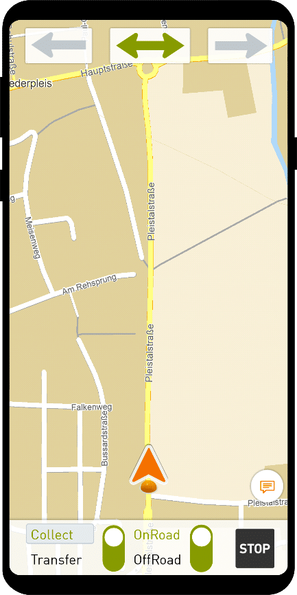
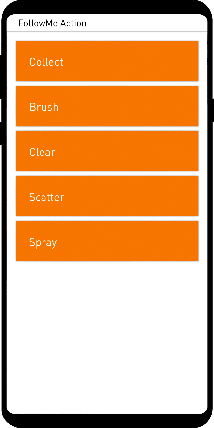
The new functions are also available in the FollowMe editor and can be entered in the route.
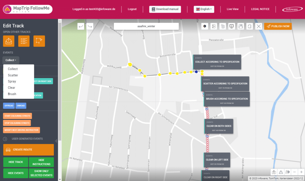
Push Service
FollowMe routes and Detour locks are now synchronized in real time while MapTrip is running. In practice, this means that the update of your FollowMe routes and your Detour locks is available immediately after editing and provisioning.
Improved Map Matching
Our map matching has been fundamentally revised. In addition to GPS, other sensor data from the device is now also used for positioning. This results in better, faster rerouting.
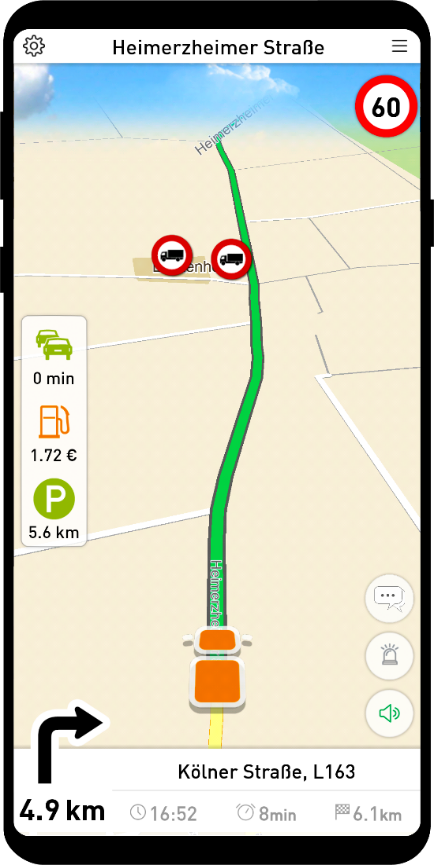
Speed limits depending on the vehicle
The speed limits related to the vehicle profile are now displayed during navigation.
Further development Detour
The new geometries provided by the server sometimes did not match the app’s local map data. Now the app adds the new geometry and splits the original roads automatically. This reduces conflicts enormously. Known conflicts were unexpected gaps in the road network and unexpected offline routing problems.
Good Bye Companion Traffic
Companion Traffic has been an integral part of our app for a long time. Since some MapTrip versions now display important information during route guidance (petrol stations, truck parking lots, delays on the route) in the Companion Map, we have decided to discontinue Companion Traffic.
This will enable us to offer new features more easily in future on the basis of a leaner application. In the course of this development, the performance of the app was improved.
3D models Directory structure
The 3D models and the corresponding PNG images are now in the folder
\maptrip\user\vehicle_model
Avoiding residential streets Make it possible to switch off
Residential streets are normally avoided by MapTrip. However, a user in the BOS environment requested that residential streets be treated as normal streets in the route calculation. This can result in shorter and more direct routes, which can be advantageous depending on the local development and road network.
This is certainly not useful in every area, but it allows MapTrip to be better adapted to the local area of use. For this reason, the avoidance of residential streets can now be deactivated via Settings.ini.
[ROUTING]
AVOID_RESIDENT=false
MapTrip Manager
The handling of device groups in the MapTrip Manager has been significantly improved.
Server-API
Numerous new functions have been created for the server API. See https://api.maptrip.de/docs/history.html
MapTrip SDK
Important extensions and changes in the SDK:
- New function Api::useMapData Activates or deactivates the usage of the map data. This is useful, if you like to exchange the map data during runtime. If the usage is deactivated, a current route guidance will be stopped and ALL references to SDK objects, except for Mapviewers , e.g. navigation, itineraries, waypoints or iterators are invalid! Calling methods on these object will result in the errorcode ApiError.INVALID_OBJECT Also if the SDK is re-initialized all existing object references will return ApiError.MTA_ERROR_INVALID_OBJECT on called member methods. Please re-initialize all static variables and class members.
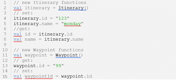
- New functions for Itineraries and Waypoints Setting and getting of name and ID attributes for itineraries and ID attributes for waypoints. These are all string parameters and can be set if the user requires them for reference purposes. They have no other internal functionalities.
- User attribute names of waypoints are handeled case insensitive. If the waypoint has an attribute with name “TelNumber”, you can get it (with Waypoint::getUserAttribute) by the name “TELNUMBER”, too.
- Improved mapmatching: The map matching algorithm was improved by combining GPS and sensory input. The combination results in more robust and faster reroutings. Therefore, you should use the new function Api::sensorData, to provide raw acceleration data and game rotation vector (without magnetic field correction). But even if you do not provide sensor data to the SDK, the matching is improved. The MapTrip Android SDK already handles this out-of-the-box.
- Improved Detour handling: The new geometry, that was provided by the Server does sometimes not fit to the local map data of the client. Now, the client/SDK adds the new geometry and splits original streets by itself. This reduces conflicts tremendously. Known conflicts were unexpected gaps in the street network and unexpected onboard routing problems.
- Disable local truck attributes: Truck attributes can be disabled as settings.ini parameter

- The usage of truck attributes for weight, length, width, etc. may be switched off. Consequently, only the truck attributes of Detour edits are used. The disabled truck attributes are not displayed in the map either. Only the pure truck locks (from the map data RS column) will continue to be displayed and used, when the user has selected TRUCK as the vehicle type.
- Default overloads: With the default overloads, street attributes of the local map material can be overloaded. You can specify the column name and the new value in the settings.ini in the new section DEFAULT_OVERLOADS. ALL roads then have this value in the corresponding column. The attributes of the Detour edits are not affected by this overloads. Examples:

- Long distance advises Reduced number of long distance advises that occur when you do not have to make a maneuver for a long time. Modified resource file: AdviceIntervals.xml
- POI visibilities POI display handling was enhanced when the application was started for the first time.
- Truck attributes for new streets Removed copy of hard restricted truck attributes for new streets.
- Detour shapes are displayed in every mapviewer Modified resource file: openlrlayout.xml and openlrPointslayout.xml
- Empty FollowMe routes FollowMeInfo::listRoutes does not return empty files anymore.
- Allow residential streets by settings.ini Disable “avoid residential streets” by settings.ini parameter in section ROUTING: AVOID_RESIDENT=false. The default is true.
- Push Service for faster updates of Detour and FollowMe files or Remote Messages.
- Privacy Manifest and Code Signing The XCFramework of our MapTrip iOS SDK now includes a privacy manifest and is signed.
Bugfixes
- Onboard route driving time Fixed driving time of onboard route, when entering a residential area.
- FollowMe me route files with unicode characters in the name Fixed handling of FollowMe route files with Unicode characters in the name.
MTI Android
New functions for copying or deleting files
With newer Android versions there are increasing problems managing files from other apps. Therefore we provide two new methods to transfer and delete files to MapTrip.
MTIFile.copyFile
val path = activity.getExternalFilesDir(null)?.absolutePath!!
val file = File(path + “/followme_bonn.nmea”)
MTIFile.copyFile(file, “mti_test/test.nmea”)
MTIFile.deleteFile
MTIFile.deleteFile(“storage/emulated/0/Android/data/de.infoware.maptrip.navi.license/files/mti_test/test.nmea”)
MTI-Coroutines
We have bundled our MTI library into a new, separate library (https://www.maptrip.de/docs/mti/coroutines.html) to provide all functionalities with Kotlin coroutines. As a result, the integration of MTI is now child’s play.
Necessary adjustments for Android 14
With Android 14, the latest Android version, there are restrictions in the use of MTI when the integrating customer app is in the background. As a result, callbacks can only be received unreliably. We therefore recommend implementing a Foreground Service (https://developer.android.com/guide/components/services) in your app.
Further information can be found at https://www.maptrip.de/docs/mti/changelog.html