DIVERA 24/7 with emergency routes
Users of the DIVERA 24/7 Alarm Monitor can now also display emergeny routes from MapTrip 112 in their system. The alarm monitor informs emergency services about the most important key data of their operation before they set off.
This also includes the location and the route to get there. Until now, the route was calculated using a standard OpenStreetMap routing. This can result in considerable deviations from reality. Roadworks can make roads temporarily impassable or cycle paths can be used in some places as a shortcut to a location. This is local know-how that no normal routing service can know.
This is where MapTrip 112 shows its strength
Free starter package
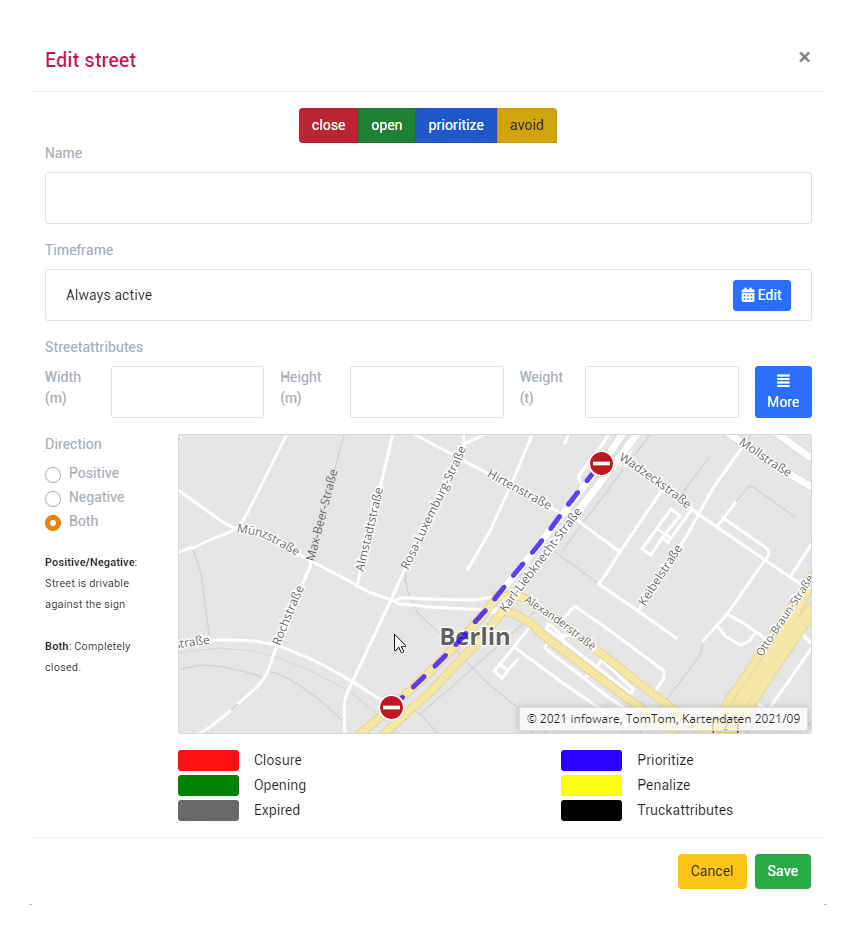
This service is free for all users in the starter package. After registering, you can edit the road maps in the MapTrip editor. The most important edits are
- Add missing roads
- Block roads
- Edit truck limits (e.g. height or weight)
- Avoid or prefer roads
In addition to the route calculation (practical emergency routes can of course be output), every user receives a free trial version of the MapTrip 112 GPS navigation system. The GPS navigation system, which was specially developed for the needs of BOS operations, automatically takes into account all changes made to the road maps. This means that not only can the emergency route be displayed correctly on the DIVERA 24/7 — alarm monitor, but the GPS navigation also helps to find the quickest route to the incident.
In the free basic version, you can work with 10 active changes.
We will be happy to advise you on fee-based tariffs for 10 or more changes.