New release GPS Navigation App 5.5 / SDK 9.5
Changelog
About this release
This release contains a lot of improvements and optimizations in detail. One focus of the development work was on the Detour functions with which the road maps can be customized. The suggestions for this came mainly from the BOS area (fire department, police, rescue services). However, they also benefit users in logistics, e.g. to correct erroneous map data in the vicinity of a logistics warehouse.
We have also made a large number of improvements in detail in both the navigation app and the underlying SDK.
Map display
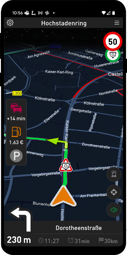
Show more street names on the map
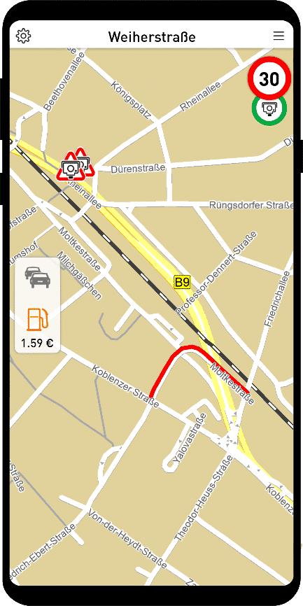
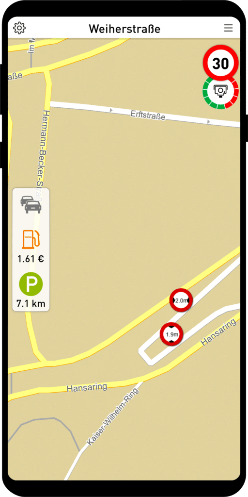
Correct display of tunnels and bridges
Roads in a tunnel are also displayed on the map below roads running on the surface. Here exemplarily shown at the Godesberger Tunnel (B9).
Display of house numbers
Via a setting in the options house numbers can be shown on the map.
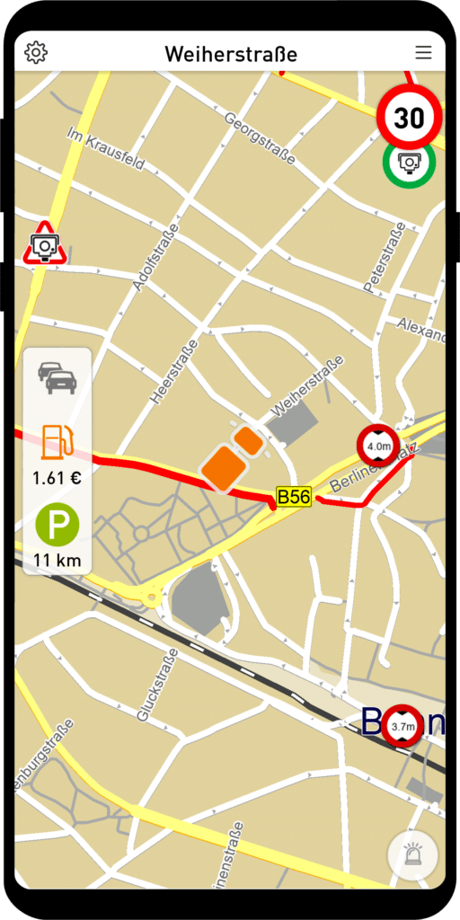
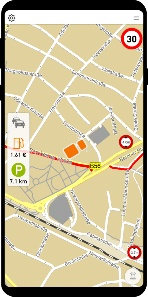
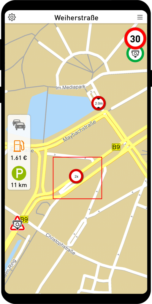
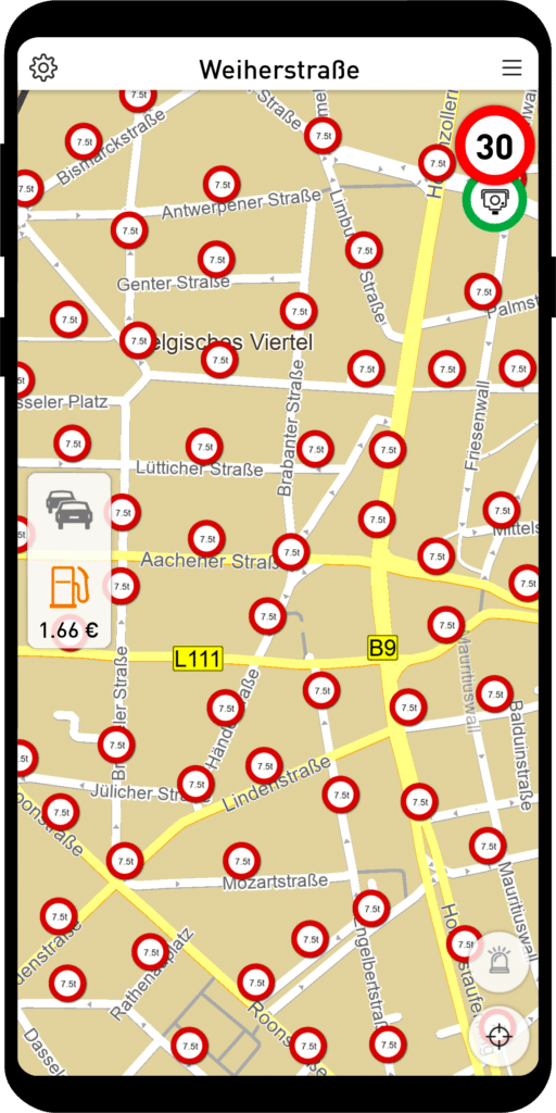
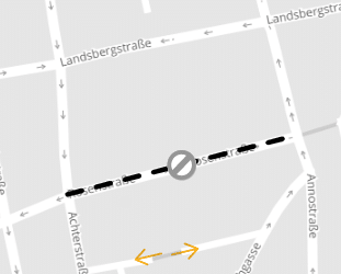
Display of multiple truck bans
Multiple truck bans on a road (e.g. a height ban and a weight ban) were displayed with a collective icon in older MapTrip variants. Now each ban is displayed individually.
Truck bans (residents free) show/hide
Often, roads in large parts of cities and residential areas are prohibited for trucks and are only open to residents. These can now be shown and hidden on the map.
The fade in/out can also be configured via Settings.ini:
[APPLICATION]
ShowSoftVehicleAttributes=1
Route calculation
Display traffic situation without traffic jam avoidance
We have provided a new option for police, fire and rescue services. The traffic situation is displayed on the map but not taken into account when calculating the route.
For this you have to change in settings.ini in section
[ROUTING]
the following entry has to be added: UseOffboardTraffic=0
Better truck routes in inner cities
Many city centers are generally closed to trucks. These areas are now better bypassed. They may only be approached if the destination is located there. The approach routes have been improved.
Radius via points adjusted
Via points can be used to manipulate the course of routes. The route must pass the via point within a certain radius. The default radii in the MapTrip Navi app, Detour editor and Server API have been aligned.
When calculating a route with via points, different default values for radii were used when no value was specified. The default value in MapTrip as well as when connecting with MTI is now 50m. We recommend to use this value if you already transmit via points with MTI.
Reference route file format unified
In all MapTrip systems, the format of the data in the reference route file has been adjusted. That is, in the Remote and Detour and FollowMe editors and in the Server API, the following is now valid everywhere:
lat, long
as structuring feature.
MapTrip App Truck Navigation
Mute speed camera warning only once or completely
In some countries there are a lot of speed cameras in a distance of only a few hundred meters. So that MapTrip does not disturb by continuous alarm, there is now the possibility in the menu Warnings to mute the acoustic speed camera warning or to output it only once. Additionally you can set the behavior via Settings.ini.
[APPLICATION]
MuteSpeedCam=0 // or 1, true, false
SpeedCamWarningLevel=1 // or 3
A setting via Settings.ini prevents the setting option in the menu.
Using favorites and destinations of a tour from Web Search
Destinations selected via Web Search now also appear in recent destinations and can be used to create a tour or favorite.
Bluetooth sound output improved
Sound output via Bluetooth has been improved so that when connected to a Bluetooth device, the sound output is always via that connection. This improves MapTrip’s behavior when listening to music at the same time or during a phone call. Alternatively, the General menu can still be used to force sound to be output through the phone speakers.
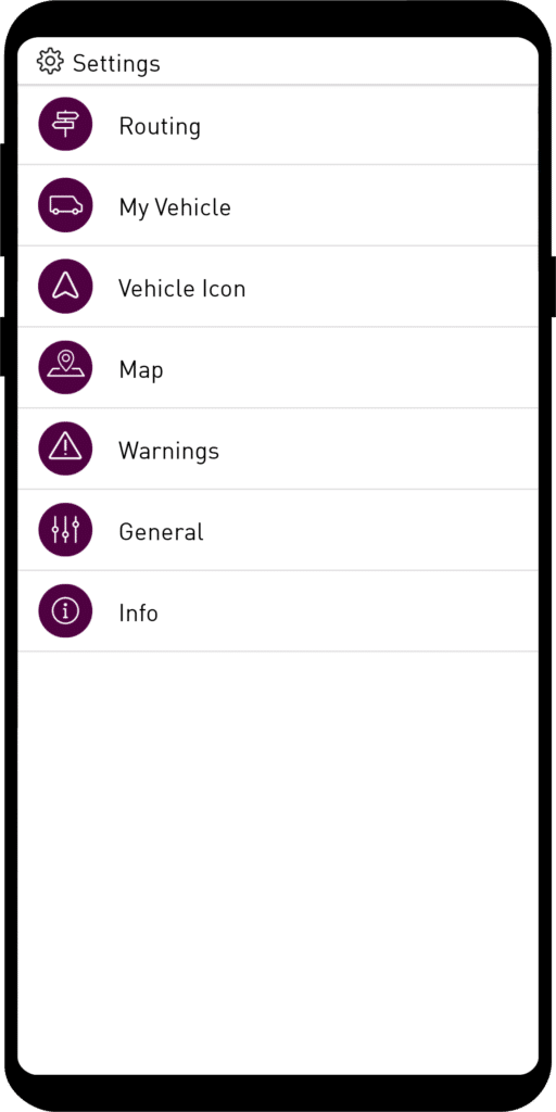
New My Vehicle dialog
We have combined all vehicle-specific settings in the My Vehicle dialog. By selecting the vehicle type, you can influence the route characteristics. You can also enter the dimensions of your vehicle.
- Truck Highway: Calculates routes for large trucks with preference for highways. Detours may be taken for this purpose.
- Truck Intercity: Calculates routes for medium trucks that also run on country roads.
- Sprinter: The routes are calculated as for a passenger car. Roads that are closed for trucks are used. However, dimensions, weight, etc. can be entered and are taken into account. The travel time is calculated as for passenger cars.
- Car: Regular car routes.
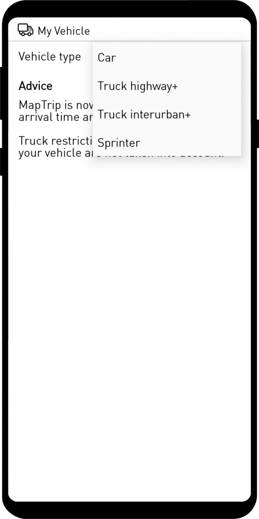
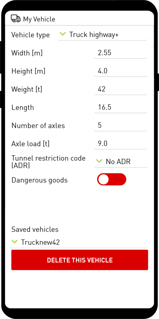
The choice of the vehicle icon is independent of the settings for the vehicle!
If you want to add your own vehicle types, this is easily possible. You change the parameters to those of your vehicle and then save the vehicle under a name of your choice.
Individual vehicle icons and 3D vehicle models
In the new Vehicle icon dialog, a vehicle icon can be selected from various 3D models for display on the map.
The selection of the vehicle icon has no influence on the route calculation!
In addition to the provided 3D models and icons, you can also add your own vehicles.
For each vehicle, a 3D model (glb file) and several png files must be provided.
\maptripuser\vehicle_model folder
Five png images must be provided for each 3D model. The png images must have the same name as the
associated 3D model.
 | Name: model.png Size: 612x552 pixels Rotation: 40 degrees left, 30 degrees down |
 | Name: model_2d.png Size: 256x256 pixels Perspective: vertical |
 | Name: model_3d.png Size: 256x256 pixels Perspective: 35 degrees |
 | Name: model_2d_grey.png Size: 256x256 pixels Perspective: vertical |
 | Name: model_3d_grey.png Size: 256x256 pixels Perspective: vertical |
Many free 3D models can be found on e.g. https://sketchfab.com/.
Night mode colors changed
The colors of our night mode have been adjusted to a current color scheme.
Detour extensions
Display of faulty segments
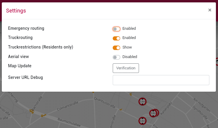
The Detour extension Map Update: Verification allows to check Detour changes in relation to new map data.
When opening the file, it checks if segments are based on old map data.
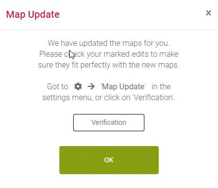
If all detour changes match the existing map data, a positive confirmation dialog will be displayed.
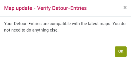
Alternatively, it is displayed whether changes could be fixed.
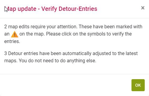
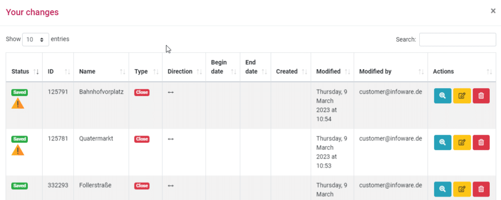
If changes could not be integrated automatically, they will be displayed with a warning icon both in the map and in the change list.
In this example, the prioritization line must be extended.
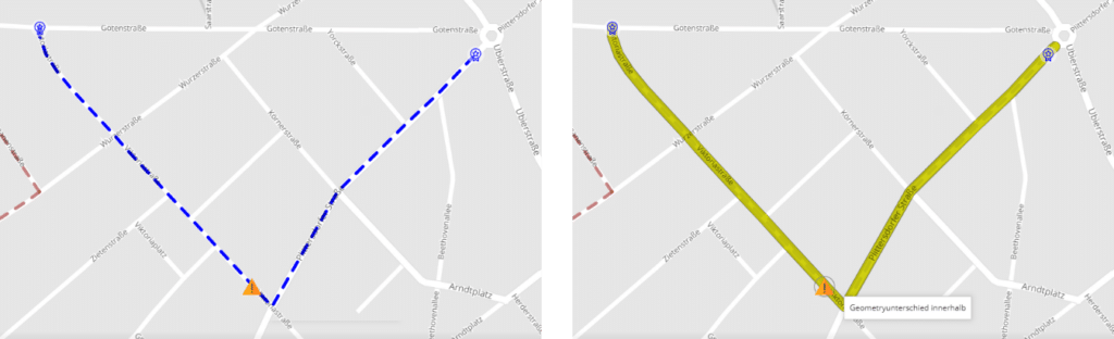
When clicking on the warning icon, a popup appears offering Fix and Ignore as options.
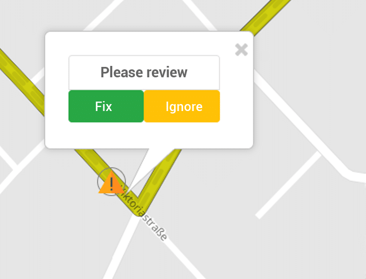
Existing changes are automatically repaired up to an error distance of 20 m. New road geometries can thus not be changed automatically, but must be reworked manually.
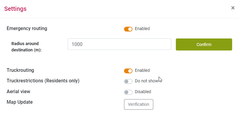
Alternatively, the map update: verification can also be started in the settings.
Detour edit: Set validity for blue light routing
For each detour change, you can now additionally specify whether it should be active for blue light routes in / outside the blue light radius.
A created segment can be assigned different blue light routing behaviors in the Detour Editor.
- Switches for relevant segments now exist for this purpose: These control the behavior inside and outside the blue light radius.
- The default setting depends on the segment types.
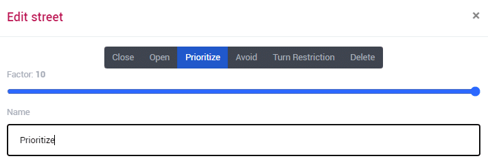
Detour edit: fine-tuning prioritize and avoid
With the new slider, the degree of avoidance and prioritization can be set more precisely on a scale from 2 to 10. The default value is 10.
Detour-Edit: Show / edit truck blocking (residents free)
In the settings menu, switches have been added to show and hide soft and hard restrictions independently of each other.
Soft restrictions can be “deactivated”. This will create a new segment without truck attributes.
Detour Edit: Split Streets
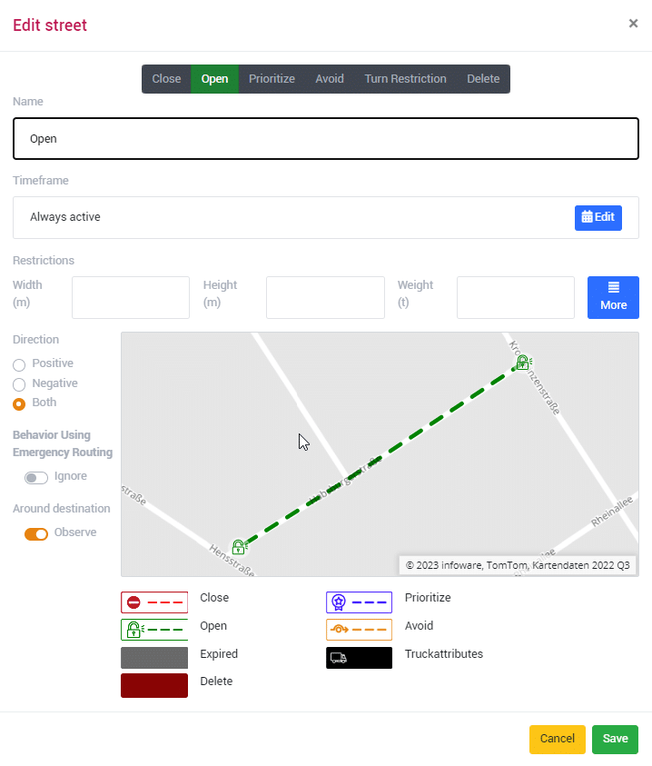
It is now possible to edit (e.g. block) only a part of a road. To do this, the road must be divided using the new shear tool.
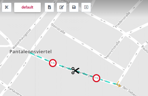
Clicking on a road creates an intersection and 2 road segments. These segments can be edited (except prioritization and avoid).
Split roads cannot be deleted individually, but must be rejoined by deleting the intersection. This functionality is also implemented in the server API.
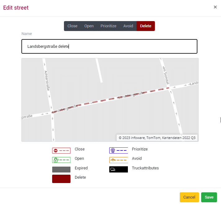
Detour edit: delete streets
With the new segment type “Remove” roads can be easily deleted. This deletes roads that, for example, no longer exist in reality or are a hindrance to the intended use. The roads are deleted from the map material. This functionality is also implemented in the server API.
Detour edit: remove / set to zero truck restrictions
It is now possible to remove or set to “zero” existing truck restrictions in the map material.
Entering the user for Detour changes
In this way, the segment list can be used to track who made the last changes.
Detour Editor — Unlock directional
A closed road can now be unblocked in one direction only. It remains closed in the other direction.
Detour editor — add turn restriction
The new Detour Editor now also opens the possibility to add your own turn restrictions to the map material.

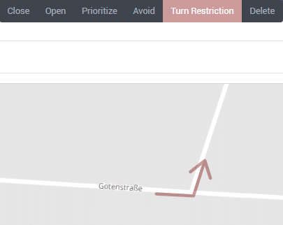
To do this, simply place 3 points over an intersection in the desired direction. Select turn restriction in the popup. Save. If possible, the segment type “Turn restriction” is displayed (screenshots).
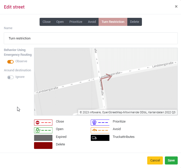
The turn restriction can be combined with attributes for blue light routing.
Compatibility of Editor / Server API with MapTrip 5.4 (and older)
Some new detour features of the editor and server API are not compatible with MapTrip 5.4 and older. Therefore, please update your entire fleet to the latest MapTrip version as soon as possible. For fleets with older or mixed MapTrip versions, we will continue to provide the old Detour Editor for a transition period at the following URL:
https://editor.maptrip.de/detour_outdated
| Feature | MapTrip 5.4 (Onboard) | MapTrip 5.5 |
| Blocking | No | Yes |
| Unblocking | No | Yes |
| Avoid | No | Yes |
| Prioritise | Yes | Yes |
| Truck attributes | Yes | Yes |
| Remove Truck attributes | Yes | Yes |
| Add turn restrictions | Yes | Yes |
| Delete road | Yes | Yes |
| New road | Yes | Yes |
| Split road | No | Yes |
| Blue light routing settings | No | Yes |
Segments created via Editor-Outdated are always compatible with 5.4 + 5.5.
For segments created via Editor-New or Server-API, please refer to the table.
Availability of the new functions
| Feature | Editor Outdated | Editor New | Server-API |
| Blocking | Yes | Yes | Yes |
| Unblocking both sides | Yes | Yes | Yes |
| Unblocking directional | – | Yes | Yes |
| Avoid / Prioritise | Yes, only fixed values | Yes | Yes |
| Truck attributes | Yes | Yes | Yes |
| Remove Truck attributes | - | follows | |
| Add turn restrictions | - | Yes | Yes |
| Delete road | - | Yes | Yes |
| New road | Yes | Yes | Yes |
| Split road | - | Yes | follows |
| Blue light routing settings | - | Yes | Yes |
| Check Detour Entries | - | Yes | follows |
| New streets with time domains | - | Yes | follows |
Other changes
MTI extension — set traffic options
Per MTI it is now possible to set in the “settings.ini” to perform the online routing with and without traffic. For this purpose the following is added in the “settings.ini” in the section [ROUTING]:
Context=0 à Online route calculation with traffic
Context=1 à Online route calculation without traffic
Routing now ignores segments that cannot be driven on
In With blue light routing, roads and turn restriction are enabled so that an emergency vehicle can reach its destination more quickly.
For blue light routing, a so-called blue light radius must be defined in meters around the destination.
When blue light routing is active, all non-one-way streets are generally enabled, i.e. also outside the blue light radius.
- highways
- ferries
- garages
- footpaths
- galleries
- stairs
MapTrip Remote — new tour handling
MapTrip always uses the new tour handling for a route with multiple intermediate destinations submitted by MapTrip Remote or Map API.
No more setting options for electr. horiz.
The “Electric horizon” setting option has been removed from the “Warnings” menu.
Nuance Language Packs
The Language Packs have been made compatible with MapTrip 5.5 (current master). The language resources are the same as those available in MapTrip Manager.
However, as before, only English, German, Spanish, Dutch, French and Portuguese are available.
Map settings easier to find
The switches for traffic messages, gas stations and truck parking have been moved from Settings/General to Settings/Map.
Changes SDK changelog for documentation
Features
- Changed callback destinationInfoReceived: The third value now has the average seconds to the destination. The old value “energy to destination” was just a proportional value to “meters to destination” with no vehicle and no route specific influence. The average drive time in seconds to the destination without traffic is only different to secondsToDestination, if the navigation uses an online route with traffic information. {# INWA-2828 Delay on route #}
- Displaying or hiding truck soft restrictions: The new function map::showExtendedSoftVehicleAttributes lets you display or hide truck soft restrictions You can also check if these attributes are visible with the also new function map::extendedSoftVehicleAttributesAreVisible.
- Display residential roads: For a better map display, the residential roads are drawn a bit thinner than other roads.
- Display of Multiple truck restrictions: Multiple truck restrictions on a single street segment are displayed separately, no combination to a single icon with the text “nx”.
- Display underground streets: Streets that lie below other streets in the underground are now also drawn below the other streets. Bridges are not drawn over other streets.
- Display more street names: Improved collision detection of labels, resulting in more displayed street names.
- Emergency routing — Unblocking of blocked roads: Emergency routing now uses all blocked roads outside of emergency radius that are not oneway, except for highways, ferrys, walkways, garages and stairs. {# INWA-2646 #}
- Emergency routing: - Does not avoid residential roads or roads with soft restrictions
Detour
- Editor: Emergency routing validity: The Detour editor now supports setting the validity of an detour edit for emergency routing. By setting the validity of a detour edit, the user can define if the record is valid/invalid for emergency routing in general and for emergency routing within the emergency radius. {# INWA-2647 #}
- Editor: Separate streets: The Detour editor now supports separating streets into smaller segments. In this way, parts of a road can be modified (e.g. closed).
- Avoid and prefer new geometry for routing: The SDK supports avoiding and prefering new streets for route calculation.
- Add turn restrictions: In addition to deleting turn restrictions, some can now also be added. Also implemented in Server API.
Bugfixes
- Fixed route calculation when the destination is in a blocked area with emergency routing enabled {# Maptrip route issue, Ticket 353258 #}
- Fixed function getCurrentlyVisibleCategory that has not listed the User POI. Modified file res/mmUserPois_template.xml.
- Fixed possible bad routes when start/destination is a highway rest stop. {# INWA-2854 #}
- Fixed possible selection of truck stops on wrong side of highway. Available with new map data. {# INWA-2726)
- Offboard routing: Fixed check for streets in emergency routing radius. {# 8385e2bf #}
- If a street is preferred by a detour edit, it will be unblocked automatically.
- Placeholder-Data: Fixed blocked loading of data in main thread.
- C‑Runtime: Check if decimal delimiter has changed to comma instead of point.
- Open-GL: Adjusted far plane for a higher camera position.
- Block next meters on Route is now more precise in dense street network.
- Fixed simulation on route, if a rerouting is triggered.
- Fixed dutch sound output with prerecorded files {# Ticket#353627 #}
- FollowMe: Supressed uploading of empty GPS files.
- FollowMe: Fixed orphaned bubles at the end of the route, if the route enda with a new collect event.
- Fixed rare cases where instances of IwMapView were not registered to the IwMapViewManager.
- Fixed: ignore location update every 5 seconds on some devices {# INWA-2992 Irregular location updates #}