Fire department operation — The GPS navigation that fire departments trust
A field report from Söffker Elektronik Barsinghausen (SEB) — GPS Navigation software quickly and directly controlled from the control center
Highest quality standards with ISO certification
During a fire or rescue service mission, it is particularly important for the driver to receive all relevant destination information as easily as possible and without transmission errors in the driver terminal. Whereas in the past, street and house numbers had to be transmitted by voice and then manually entered into the GPS navigation device, today all relevant mission data is transmitted digitally and in encrypted form via the protected TETRA-BOS public authority radio. GPS Navigation starts automatically and additional mission data can be displayed. The driver can concentrate fully on the blue-light journey right from the start. The technology that handles the GPS navigation and radio communication comes from the company Söffker Elektronik Barsinghausen (SEB). SEB has been a partner for authorities and organizations with security tasks (BOS) since 1975. The ISO-certified company develops and produces the majority of its own hardware to the highest quality standards.
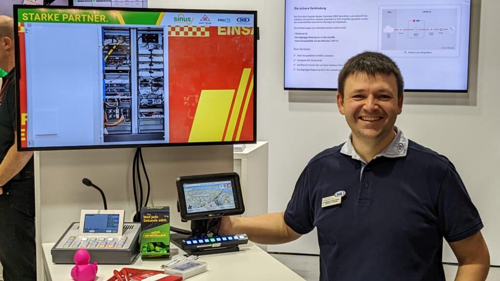
At the PMR EXPO in Cologne we had the opportunity to talk to Markus Köberle, Martin Stebner and Jens Bärwolf from SEB. They have integrated our GPS navigation software MapTrip 112 into the mission guidance system SEB Drive².
Mission GPS navigation MapTrip 112
With SEB Drive², the driver of the emergency vehicle immediately receives all mission-relevant information and has the GPS navigation immediately in view. MapTrip Navigation receives the data directly from the control center.
The fact that many fire departments are not allowed to use a mobile Internet connection for security reasons is already taken into account when using the GPS navigation, as Markus Köberle explains: “Since our customers’ devices are not allowed to be connected to the Internet, MapTrip Navigation is calculated offline. For this reason, the alert from the control center is transmitted via Tetra BOS radio. Up to 600 characters can be transmitted.”
The destination is thus transferred to MapTrip, as can be seen in the figure below:
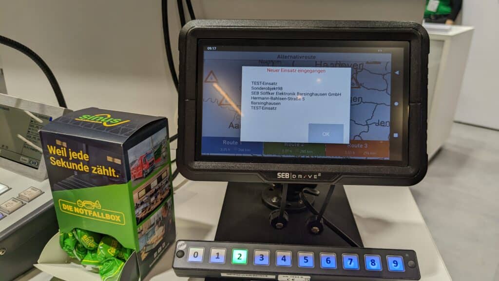
In addition, it can be configured whether alternative routes should be displayed or whether the fastest route is started immediately.
Know all road works — even without permanent internet connection
With the MapTrip Detour function it is possible to enter road works and closures into the map data depending on direction and time. In the Detour web editor, these closures can be created and edited conveniently on the computer. Authorized MapTrip 112 installations can then automatically access the closures and — after they have been loaded onto the devices — take them into account offline in the route calculation and route guidance.
For example, a road can be closed in the editor for the next 3 weeks due to a construction site, consequently the road will then not be used in the route guidance during these 3 weeks. Once the closure has expired, the road will be used again in the regular way. However, time-dependent and recurring closures can also be made, e.g. a weekly market every Wednesday afternoon.
Markus Köberle explains how SEB uses this: “The location of current road works can be easily entered centrally in the Detour Editor. When the vehicles are in the hall, they have the opportunity to load the current construction sites and changes via WLAN. This way, they are taken into account when calculating routes even if the devices don’t have Internet while on the road.”
But not only road works/blocks can be entered with the Detour Editor. MapTrip Detour gives users a comprehensive tool to edit road maps independently and quickly. Users can make the following changes:
- Add missing roads in the map data and see them directly in the GPS navigation.
For new roads, e.g. in new construction areas, one often has to wait for months until the next release of the map data providers. With MapTrip Detour you can act on your own. The streets can be drawn into the map by a simple mouse click and are then directly visible in the GPS navigation.
- Approaches to special objects
Special access roads, which are not allowed to be used by normal road traffic and therefore probably will never be included in the map data of the providers, can be inserted and made usable by yourself without waiting time.
- Fair / folk festival
Draw paths and stand numbers on the map to enable rapid and targeted access for emergency services, even at temporary events.
- Change turn regulations
Especially in the field it can save enormous detours in route calculation, e.g. to switch off a left turn restriction at an intersection, which can be taken in case of emergency after all.
- Edit truck restrictions
Hereby height and weight restrictions can be added and edited. For example, a height restriction at a tunnel can be added. Or the weight restriction at a bridge can be changed, which can be used in exceptional cases.
- Unblocking, prioritizing and avoiding roads
Roads can not only be blocked, but also unblocked, such as a pedestrian zone. Prioritizing and avoiding roads acts like a magnet, allowing roads to be used preferentially like a yard exit.
- Blue light radius
These are special functions for emergency drives. In an adjustable radius, e.g. 100 m or 1,000 m, around a GPS navigation destination, restrictions such as turning regulations and one-way street regulations are automatically canceled in the “Blue Light Radius” mode. This means that the approach can be made in the last mile even in the opposite direction of travel. Of course, tunnels and roads with structurally separated lanes are excluded. In addition, the voice announcements during route guidance are adapted to the higher operational driving speeds.
In addition to the web editor, transmission is also possible on the server side (via server API).
Integrated into your own application in no time via QuickUI
The GPS navigation software can also be integrated into a mission guidance system via SDK. An SDK (Software Development Kit) is a construction kit for developers that can be used to add all GPS navigation functions to their own application. Thanks to the new QuickUI, this can be done within a few days without much effort.
If you have any questions about the SEB operational guidance system SEB Drive², Markus Köberle and his colleagues will be happy to hear from you: info@goseb.de.
For all questions about MapTrip 112 and the possible integration methods, our sales team will be happy to advise you.