GPS Longitude and Latitude
Remember Longitude and Latitude — about the difficulty of remembering longitude and latitude and how Obelix can help with that
You would think that everyone in a navigation software company would be able to memorize longitude and latitude right away, even in their dreams. After all, this is the most fundamental unit of information in this business. The longitude represents how far you are from the equator and the latitude the distance to Greenwich… or was it the other way around???
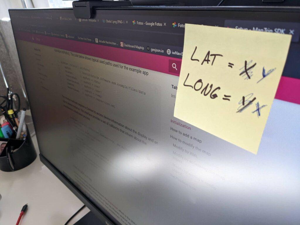
And yet you always see such yellow sticky notes stuck to the monitor like the ultimate insurance against catastrophic twists!
The point on the globe or the point on the map is what we constantly work with. A navigation does not know addresses, it only knows points. Anyway, before anything can be calculated, the address is first converted into a coordinate. This is done by the geocoder of a navigation. The result is a pair of numbers like 50.73658394304897, 7.091699781133922 (our office in Bonn) or ‑55.63739732777102, ‑68.07445351644245 (Tierra del Fuego in Argentina).

Every sailor or pilot also knows that you first indicate your position in north/south and then in east/west. However, it is a bit more confusing with software: If you want to communicate a destination to the navi via interface, you have to transfer longitude and latitude separately. The documentation defines this quite clearly — but what was the longitude again and what was the latitude? Is longitude north/south and latitude east/west or was it the other way around? So that one does not come here totally confused, one makes oneself nevertheless rather a small yellow note at the monitor.

Or you have a good mnemonic! Obelix attaches much importance to the fact that he is not fat but big! Therefore he also wears a longitudinal striped trousers “which makes slim” or just long! Clearly, the longitudinal stripes on Obelix’s trousers correspond to the longitudes! And the thick green belt is then the latitude.
Quite simple: Who has read Asterix and Obelix extensively in the childhood, has clear advantages later in the life as a navigation developer!