New release Android MapTrip 5.3
Add missing roads to the road map
MapTrip 5.3 / SDK 9.3
As the first professional GPS navigation, MapTrip now offers the possibility to add missing roads yourself and amend them ad hoc to the road map! For this purpose, the Detour Editor has been extended with functions for drawing roads.
Typical use cases:
- Add missing roads in new development areas that are not yet included in the regular street maps from TomTom, Here or OSM.
- Adding yard entrances to the public road network.
- Adding roads on a company site
In the Detour Editor, a new button calls the function for drawing roads.

they are synchronized with the GPS Navigation immediatelly.
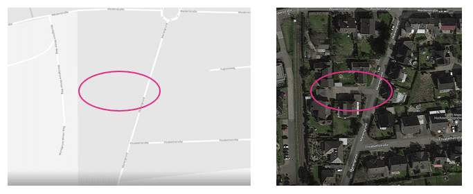
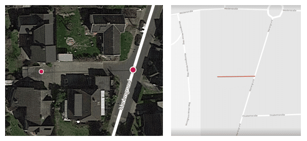
Example how to add missing roads
A small road is not included in the standard maps from TomTom, Here and OSM. Via the Detour editor it can be added with a few clicks and sent to the GPS navigation devices.
Note: The new streets cannot be provided with addresses and are not found via the address input!
MapTrip App and SDK
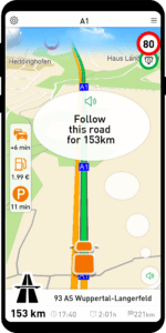
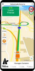
Announcement “Follow this road for 153 km”.
Instead of the announcement “Follow the road for a very long time”. Now the concrete distance for which the current road should be followed is announced. So e.g. “Follow this road for 153 km”.
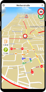
Gas stations and fuel prices across Europe
MapTrip now displays gas stations and current fuel prices across Europe.
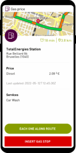

When reaching a selected gas station, MapTrip calculates the savings by selecting this gas station. The savings are calculated from the price difference of this gas station to the average price of all gas stations along the route.
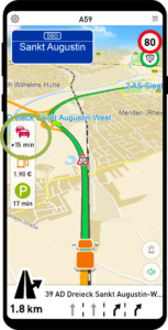
Display gas station / parking lot / delay in Companion_Map
The Companion_Map now also shows the cheapest gas station and the nearest car park. By clicking on the corresponding icon, a detailed dialog is displayed and the gas station or the parking lot can be inserted into the route as an intermediate destination.
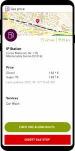
In addition to the distance to the gas station, the travel time to the gas station is also displayed when destination guidance is active.
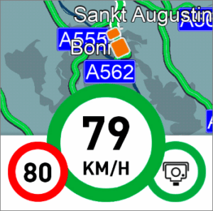
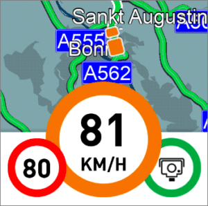
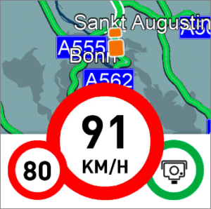
Truck speed indicator green/orange/red
We have adapted the speed display in Companion Traffic to the realities of truck driving.
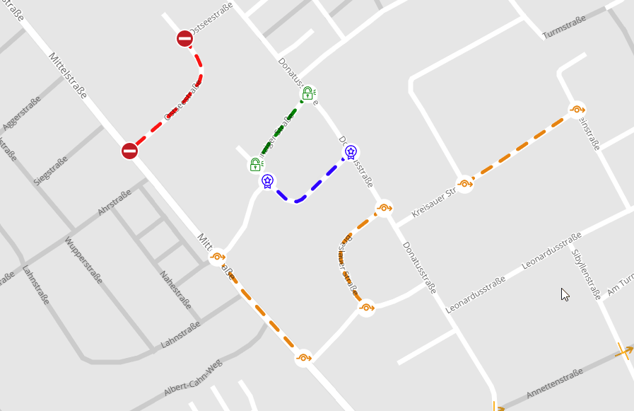
Viewing Detour Edits in MapTrip
With the Detour Editor, individual changes can be made to the road maps. The changes are automatically synchronized with your own MapTrip GPS navigation apps.
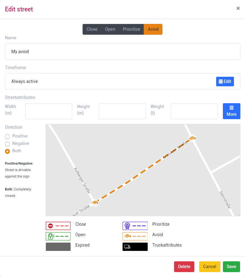
The following changes can be made in the Detour Editor for GPS navigation and for route planning:
- Close roads
- Open blocked roads
- Prioritize roads in route calculation
- Avoid roads in route calculation
- Disable turn restrictions
- Draw and add new roads
- Edit and create truck restrictions (length, width, weight etc.).
The display in the editor and in the GPS navigation is now consistent.
MapTrip Interface MTI
Transfer truck profile with name via MTI
Via MapTrip Interface (MTI) a truck profile with a name can now be passed.
The profile contains the dimensions of the vehicle and other parameters. It is displayed with the passed name in the MapTrip application. The settings of the profile can be viewed by the driver but cannot be changed.
A truck profile transferred via MTI is automatically reused by MapTrip even after a restart. It does not have to be set again after each start, but remains active until another profile is selected.
Traffic
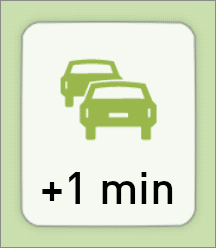
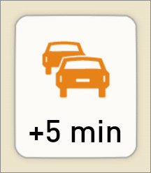
Delay on the route green/orange/red
The Traffic button on the left side of the map shows the delay caused by the current traffic situation on the route. MapTrip always uses the fastest route. However, due to the general traffic situation, it may still contain a delay compared to the average traffic situation.
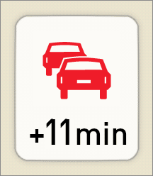
Read out traffic jam messages
If at the start of route guidance the delay on the route is greater than 5min, it will read out “Your route contains x minutes of delays. This is the fastest route.”

If traffic messages are available for the current route, they will be read out.
Please note that a route may well contain delays without traffic messages being available at the same time!
You can also configure or suppress the TTS output via Settings.ini:
[APPLICATION]
MuteTrafficEventList=1
TrafficDelayAnnouncementThreshold (default=5) Delay on the route in minutes, from which a TTS announcement is made with reference to the current delay.
TrafficDelayAnnouncementTimeDelta (default=30) Time interval in minutes between two TTS announcements with indication of current delay.
Administration
More information in the info window
If there are problems with MapTrip, it is very helpful to have as much information as possible about the installation and settings.
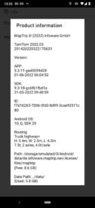
We have therefore made the information dialog more detailed. This makes it easier to solve problems in case of support.