MapTrip 4.9: The new release of the Truck GPS App is out now
In the new release 4.9 there are some new functions with which our Truck GPS App MapTrip can be used even better. We have compiled an overview of some of the innovations for you.

New function: Improvements of Companion Map
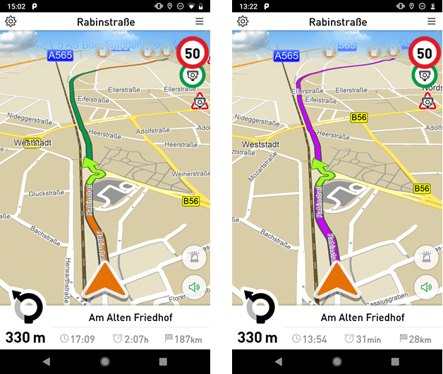
During navigation the traffic flow will now be placed on top of the route. In the colors green, orange and red the route shows the traffic conditons ahead.
In case you upgrade from a previous MapTrip version, you must replace the files «color.xml» and «mapservices.xml» in the MapTrip folder. If now flow data were considered or the route was calculated on board, the route will be displayed as usual.
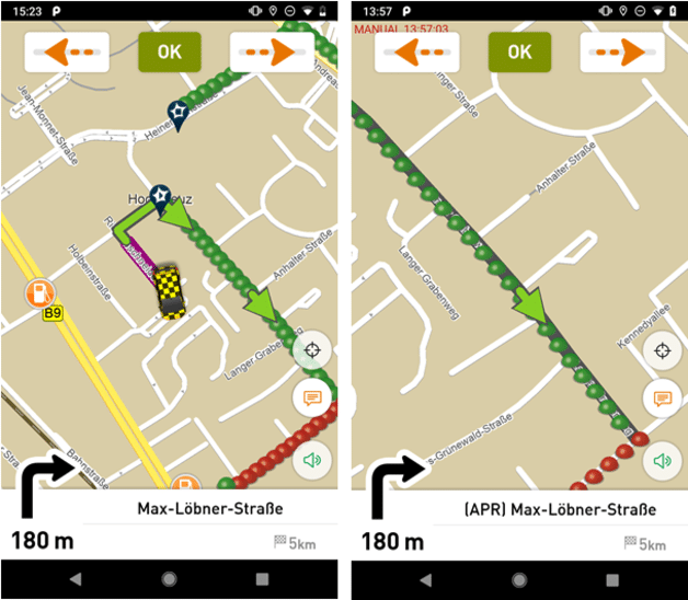
New function in MapTrip FollowMe: Move Arrow
MapTrip FollowMe is the GPS app for Waste Management, Street Cleaning and Winter Services. The app is based on the truck gps MapTrip Truck but has extra features necessary for driving very complex routes.
The “Move arrow” feature is used when an unexpected obstacle blocks the route and prevents the driver from following the route for a segment. The user can then move the arrow to a point further down the track, to show the app where he can continue to follow the route.
The behaviour of the FollowMe function «Move arrow» could be improved significantly. Now both vehicle and arrow are displayed in the map area at once when their distance is low. When moving the arrow further away the map area follows the arrow.
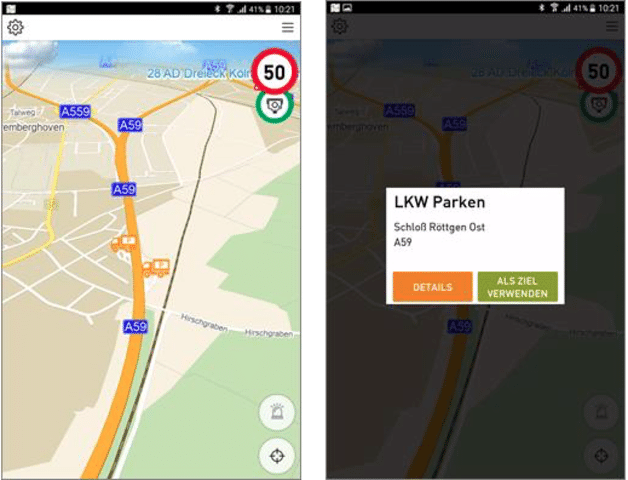
New function: Use truck parkings as destination for the GPS app
In the MapTrip Truck GPS app parkings can now be used as destination from the detail view. Also available is the feature which shows parkings that are directly on the route ahead. At a tap of a button they can be inserted into the route.
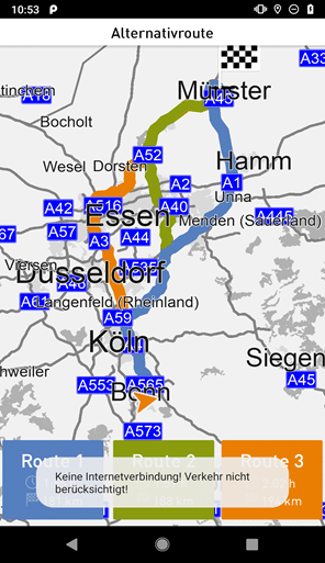
New function: Notification when calculating routes without internet connection
In addition to the improvements of companion map a notification warns now when a route was calculated on board, even though the licence includes off board routing. Typical cases are searching of a route or rerouting with missing internet connection.
The app uses real-time traffic information of your choice of either TomTom or Here. Both suppliers are considered the best in the market and provide excellent traffic avoidance and exact ETA calculation.
New function in MapTrip 112: Set Emergency Route Radius
The emergency radius is a settings parameter in MapTrip 112. It sets the radius around the destination within the emergency routing should be used.
New functions:
- Set emergency route radius
a. Navigation::setEmergencyRouteRadius(int meters) - Get emergency route radius
a. Navigation::getEmergencyRouteRadius()
Improvements of MTI Geocoding:
Use case: An application sends an address with wrong house number as destination to MapTrip via MTI.
If there is no house number found in the map data, the middle of the street will still be used for geocoding. For catching this case, for example to display a warning in the calling application, «MTI_ERROR_NO_HOUSENUMBER_FOUND» will be returned instead of «MTI_ERROR_OK».
Want to learn more about MapTrip 4.9 and its other features? Please feel free to contact us at any time.