Changelog MapTrip Detour Editor
November 2023
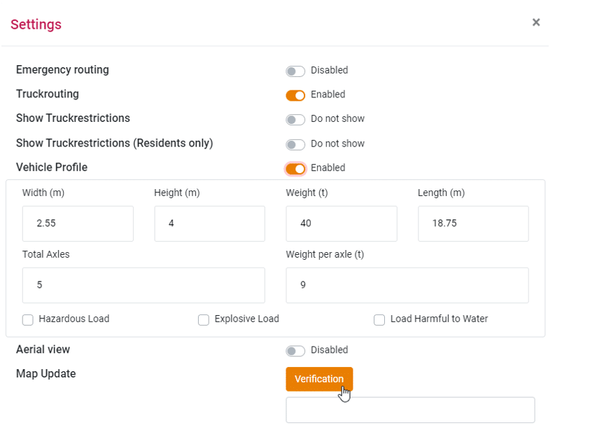
Vehicle profile activation is now accessible through the settings
You can now enable or disable the vehicle profile in the settings.
The input fields come pre-filled with default values and can be overwritten with your own measurements.
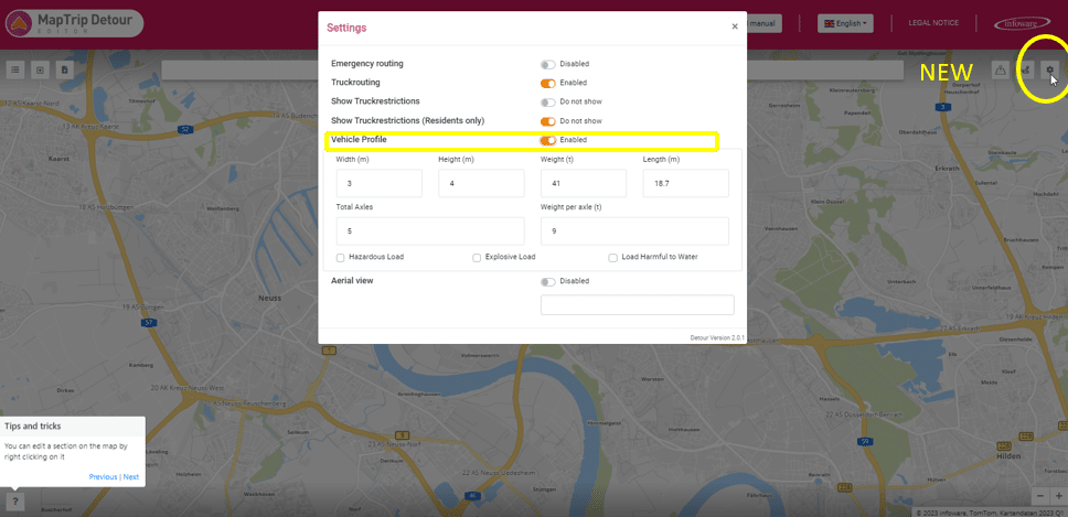
If a vehicle profile is activated, it is used for route calculation for every vehicle type.
Activation of Emergency routing = activation of the vehicle type car
This is one of the most significant updates to the Detour Editor. Activating Emergency routing now automatically activates GPS navigation in car mode. In other words, Truck routing is now automatically deactivated in emergency routing.
This allows all roads to be considered for route calculation in Emergency routing, even those with a general truck restriction based on road type.
However, real limitations such as road width, which also apply to emergency vehicles, still exist.
To ensure that vehicle dimensions are still considered in Emergency routing, you can use your individual vehicle profile.
When a vehicle profile is activated, your dimensions, such as vehicle width, will also be considered in route calculation in car routing.
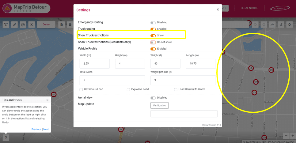
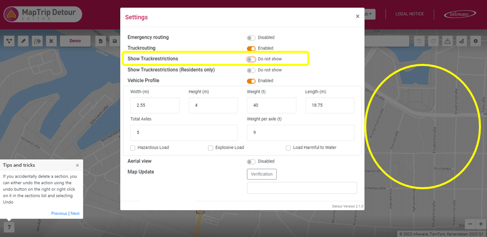
Show Truck restrictions
With this button, you can display or hide the truck restrictions on the map.
This function does not affect the route.
If a vehicle profile is activated, the dimension restrictions (height, width, weight, etc.) will be considered during route calculation.
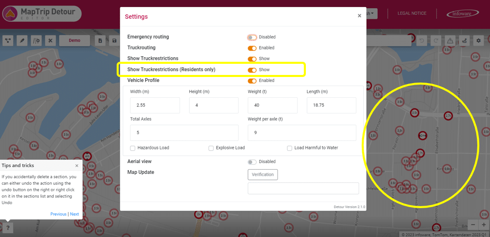
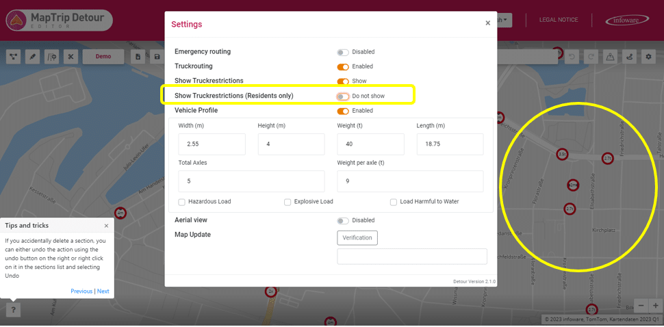
Show Truck Restrictions (Residents only)
With this button, you can display or hide truck restrictions for all truck-residents-only roads on the map.
This function does not affect the route.
If a vehicle profile is activated, the dimension restrictions (height, width, weight, etc.) will be considered during route calculation.
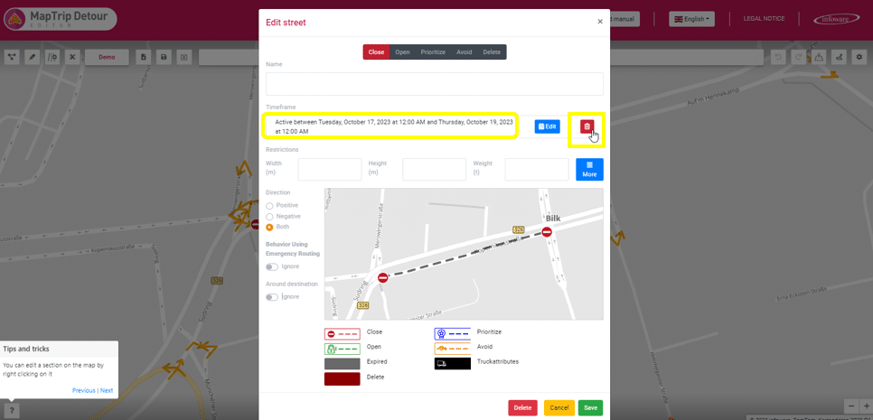
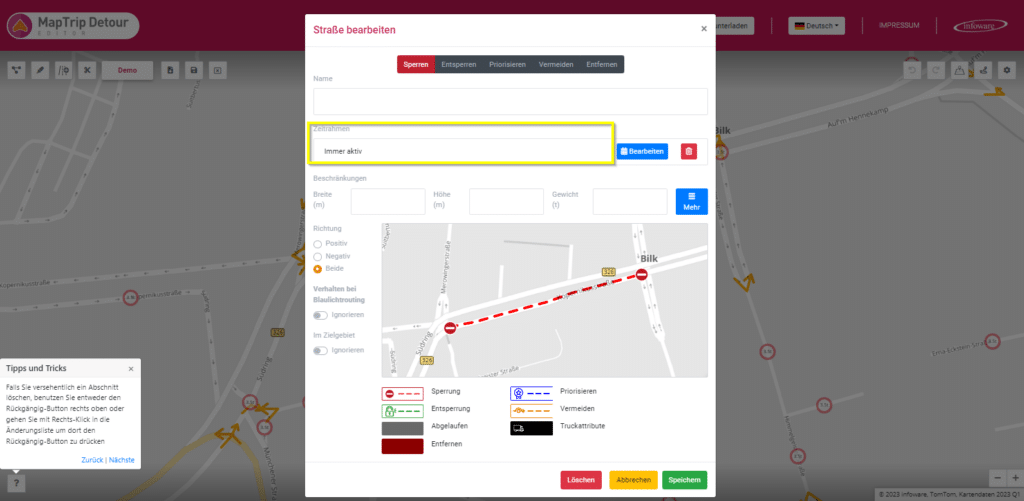
Deleting Time Restrictions on Segments – Permanently Active
For segments with a specified time restriction, such as from Tuesday 08:00 to Thursday 18:00, there is now an option to effortlessly remove this time restriction by clicking on the new trash bin icon. This action permanently activates the respective segment.
Please note, as with any changes to segments, double saving is required to confirm the modifications made.
Glossary:
Here, we reiterate the terms and functions of the new Detour Editor, allowing the creation and editing of detours, among other features.
All activations in the editor (Emergency routing, Truckrouting, vehicle profile) only affect the editor’s functionality and have no impact on the end devices. These settings must be made directly on the end devices.
Emergency Routing: In an adjustable radius, e.g., 100m or 1,000m, around a destination, restrictions such as turn requirements and one-way street regulations are lifted in Emergency routing mode. The approach to the destination can thus be made against the direction of travel on the last mile. Exceptions include tunnels and roads with physically separated carriageways. In addition, voice instructions during route guidance are adapted to higher emergency vehicle speeds.
Truck Routing: In truck routing, all general restrictions for trucks specified in the map data based on road type are considered. Route calculation in truck routing considers the aforementioned truck restrictions. Dimension restrictions (height, width, weight, length, axle load) are observed when the vehicle profile is activated.
Show Truck Restrictions: With this button, you can display or hide truck restrictions on the map. This function does not affect the route. If a vehicle profile is activated, dimension restrictions are considered.
Show Truck Restrictions (Residents only): With this button, you can display or hide truck restrictions for truck-residents-only roads on the map. This has no impact on route calculation, and the restrictions continue to be considered when a vehicle profile is activated.
Vehicle Profile: Here, you have the opportunity to enter the individual dimensions of your vehicle. When the vehicle profile is activated, it is used in route calculation.
Example: If there is a height restriction of 3m on a road, with truck routing activated without a vehicle profile, the route goes through.
With the vehicle profile activated and a vehicle height of 3.1m, the road is avoided in both car and truck routing.
Map Update: After a map update, this button checks your segments to ensure they still match the new map data. If corrections are necessary, you will receive a notification.