Integrate Wasserkarte.info into MapTrip 112
With Wasserkarte.info you can easily enter all water intake points in your area of operation and transfer them to the MapTrip 112 GPS navigation map. This way, the driver can see at a glance where water intake points are located along his route or destination. We will show you here how to integrate it into the GPS navigation.

Emergency GPS navigation with integrated water tapping points
Wasserkarte.info develops software for municipalities and fire departments. You can use the software to record all water intake points such as hydrants or fire ponds in your operational area. These are then synchronized with the MapTrip 112 GPS Navigation, an operational navigation especially for fire departments, and displayed on the map. The driver thus sees the water intake points with all mission-relevant information along his route or destination. GPS navigation to the intake points is also integrated.
To do this, you need to perform the following steps, which we explain in detail in each case:
- Registering your company and downloading the MapTrip 112 app.
- Registration on Wasserkarte.info. (If you already have an account on Wasserkarte.info log in with your account).
- Create water intakes in Wasserkarte.info.
- Create access key in Wasserkarte.info.
- Enter access key in MapTrip 112 app.
- Done - The intake points are now synchronized with MapTrip GPS Navigation and displayed.
Please note: The water intake point will be taken over during the first initialization and in the further course the synchronization will be done overnight. This means, all further water intake points created by you will be displayed in the GPS navigation the next morning.
The steps are explained in detail here:
Download MapTrip 112 on your Android device (tablet/mobile).
- Go to the MapTrip 112 download page.
- Register your company. You will receive an email from MapTrip Support - click Activate account.
- You can now log in to download with your EMailAddress and password.
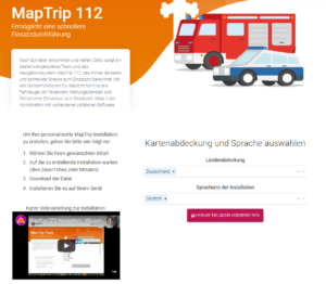
- Select the country coverage and language of the installation.
- Create and download APK.
- Copy the APK to your device.
- Install MapTrip (APK under own files) and load map data.
Now switch to the website Wasserkarte.info
Now switch to wasserkarte.info - Log in.
- If you already have an account, log in with your access data.
- If not, select: Create new account.
- Create a new account.
- You will receive another email from wasserkarte.info Support - Verify email address using the link.
- Click on Verify Account and fill in your organization's data in the settings.
- Select the default map section for your area of operation by scrolling and zooming.
- Save.
Please click through the images:
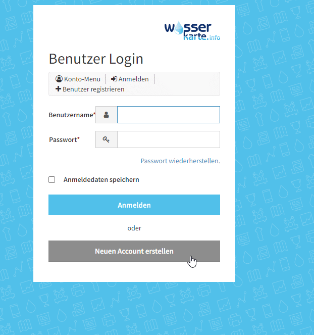
Create a new account or log in with your existing account.
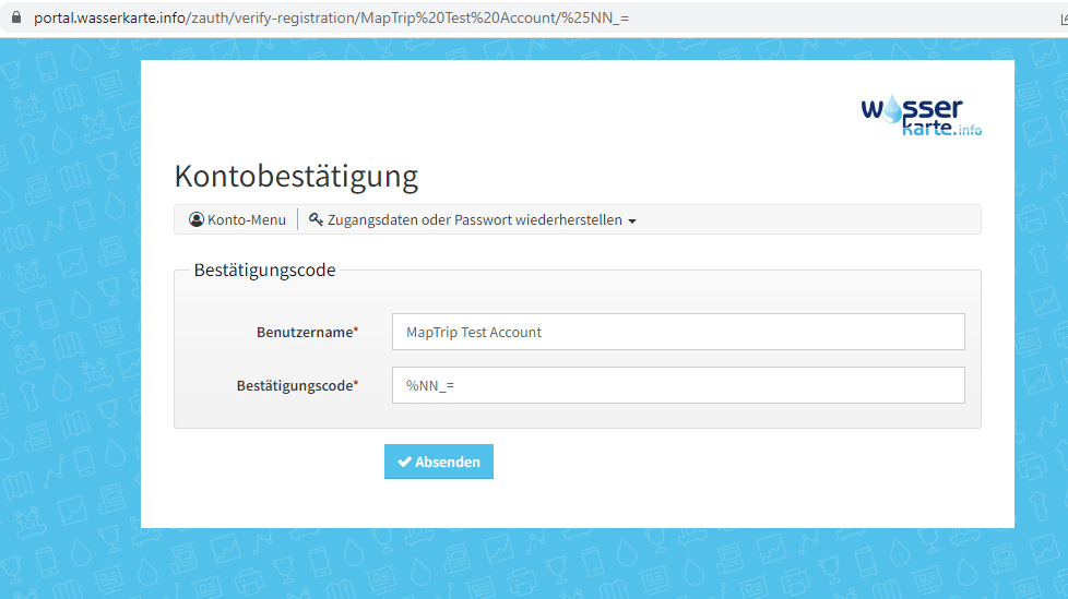
Click Submit.
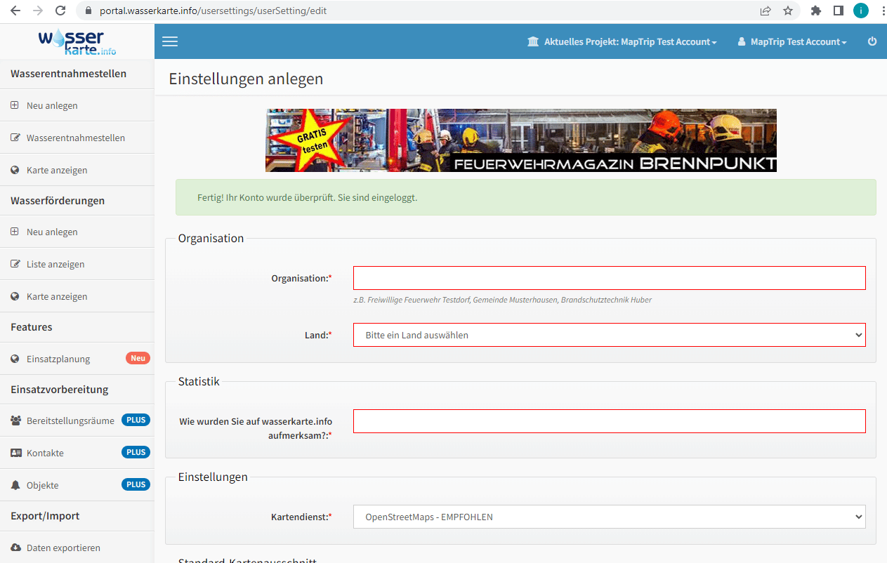
Enter your data here. You can keep the preset map service.
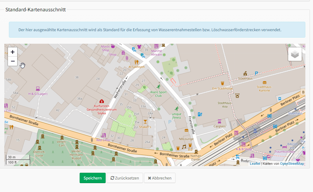
Select your default map section by zooming and scrolling, which will then appear as the default.
Create water intake point
Now you can insert your water sampling points into the map. The water extraction point will be displayed in the MapTrip navigation map at the position where you insert it in the Wasserkarte.info map.
- Click in the left menu bar under Water Intake Points: Create water intake point.
- Fill in all the information relevant to the operation of the water intake point.
- Place the marker on the map at the location of the water intake point.
- Save.
Please click through the images:
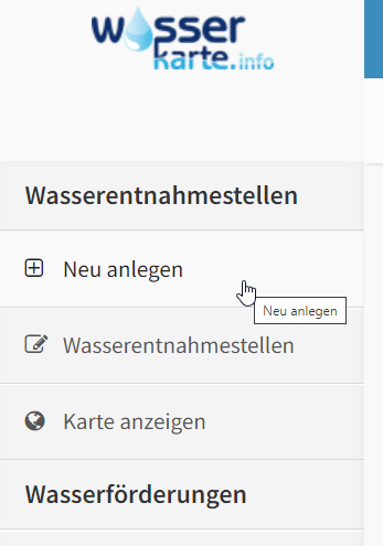
Under Water points, select: Create new.
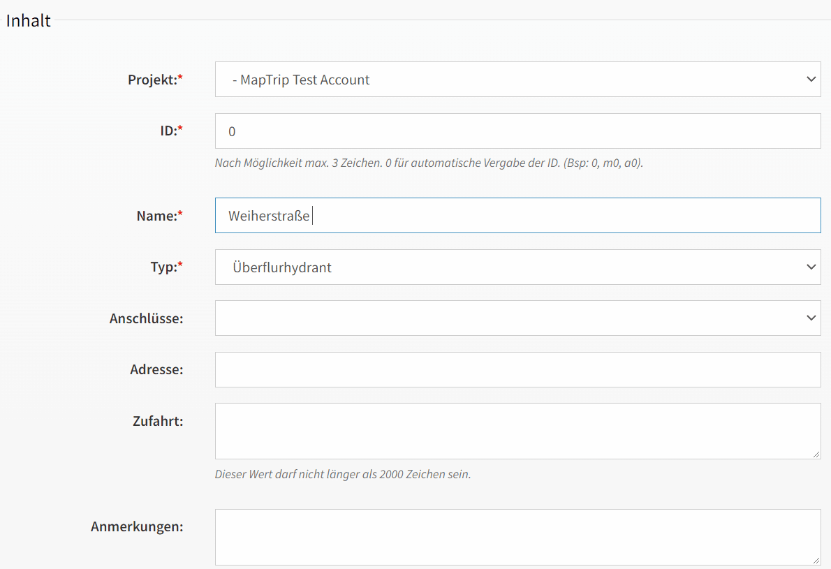
Fill in the relevant information about the water intake point.
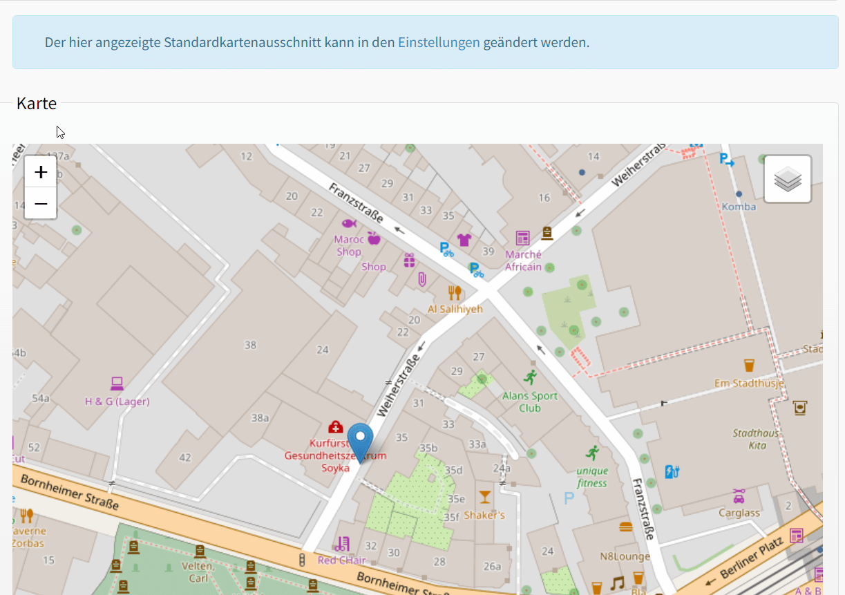
Click in the map at the place where you want to insert the water intake point. Save.
Create access key in Wasserkarte.info
Now an important step takes place. To establish synchronization between Wasserkarte.info and MapTrip 112 you need to generate an access key to Wasserkarte.info, which you then enter in the MapTrip app.
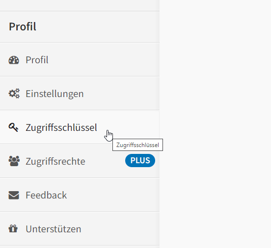
- On the Wasserkarte.info website, scroll down the page a bit - in the left menu bar you will find the Access key item.
- Click on Create access key.
- Important - under Notes, type the word maptrip in the blank space (lowercase and spelled together). Also make sure there is no space before the word.
- In the dropdown menu under "Connected system" select: MapTrip 112 (only available with PLUS license).
- You will now receive an access key, which you enter in the MapTrip app.
This will allow synchronization between your account and the wasserkarte.info.
Scroll down relatively far in the left menu bar and click on Access Key.
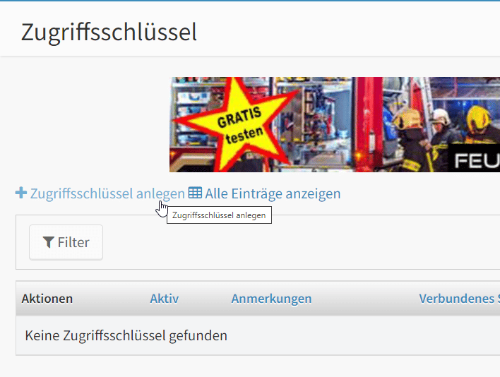
Click Create access key.
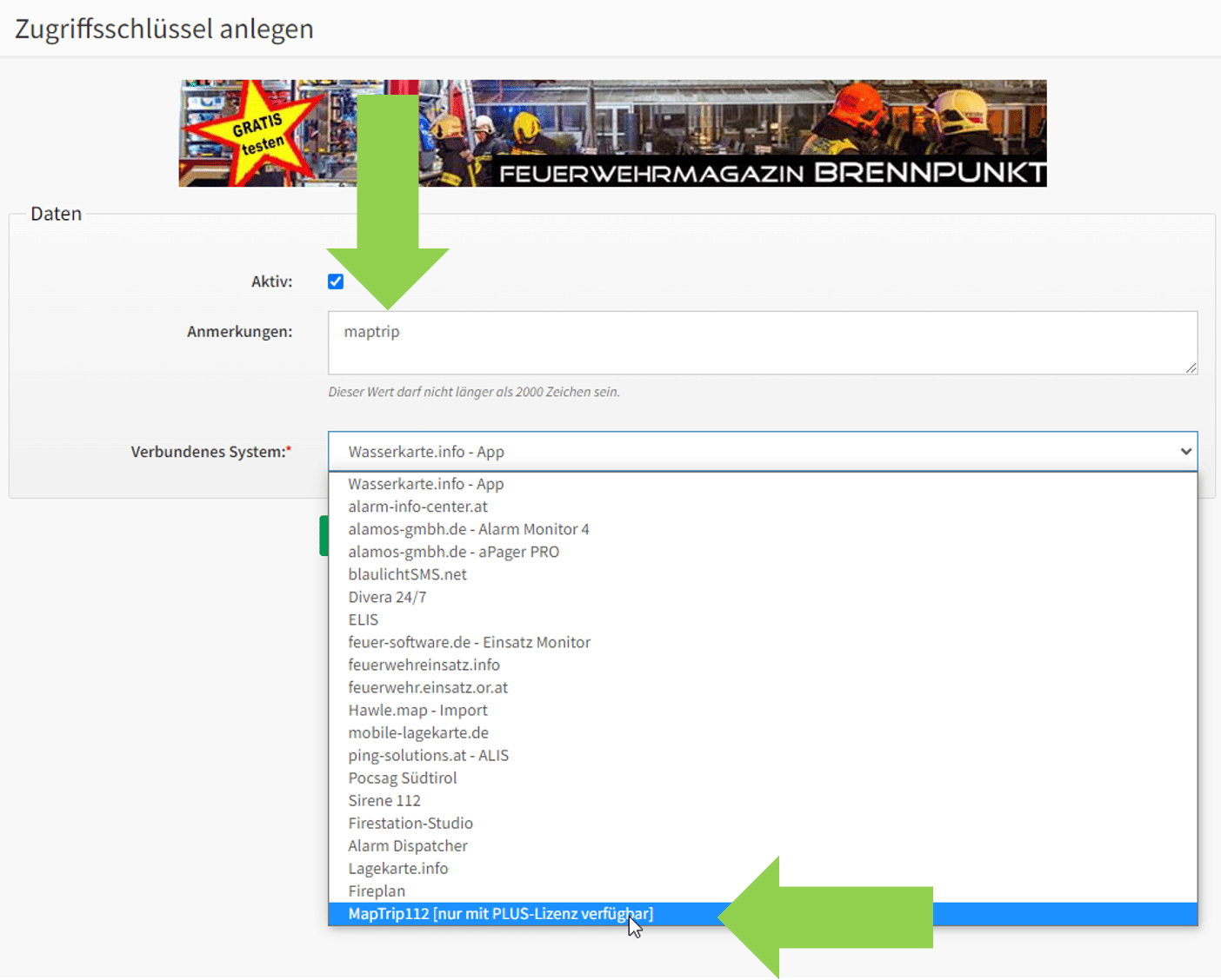
Type in the free field maptrip in small letters, all written together. Under "Connected system" select MapTrip 112 and save.
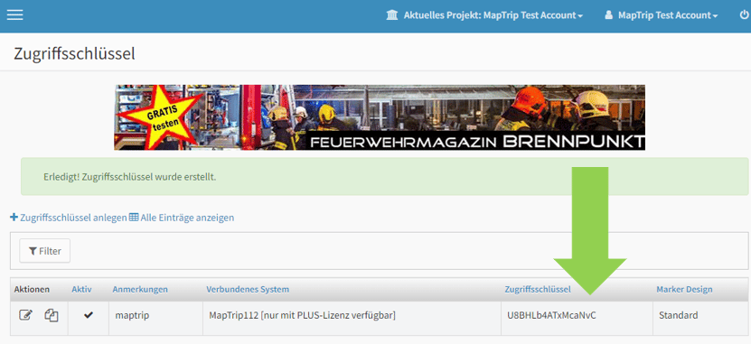
You have now received the access key, which you enter in the MapTrip app in the next step.
In the MapTrip app
You still need to enter the access key in the MapTrip app itself.
- Open MapTrip.
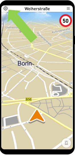
- Go to the settings( gear on the top left).
- Tap on the last menu item: watermap.info.
- Type in the access key. Pay attention to upper and lower case.
- Tap again on Settings (cogwheel) - Map - POI Display. Please check if the category Water map is selected (green tick).
- Done - you can now see the already created water points in MapTrip navigation.
- By clicking on the icon all important information about the water point will appear. If you click on Details, you will return to the Wasserkarte.info page or the Wasserkarte.info app.
Please click through the images:
Go to the settings
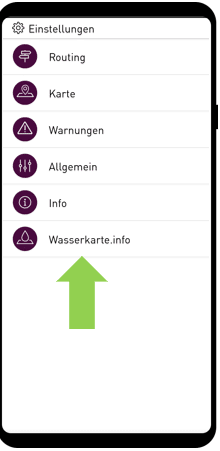
Tap Wasserkarte.info
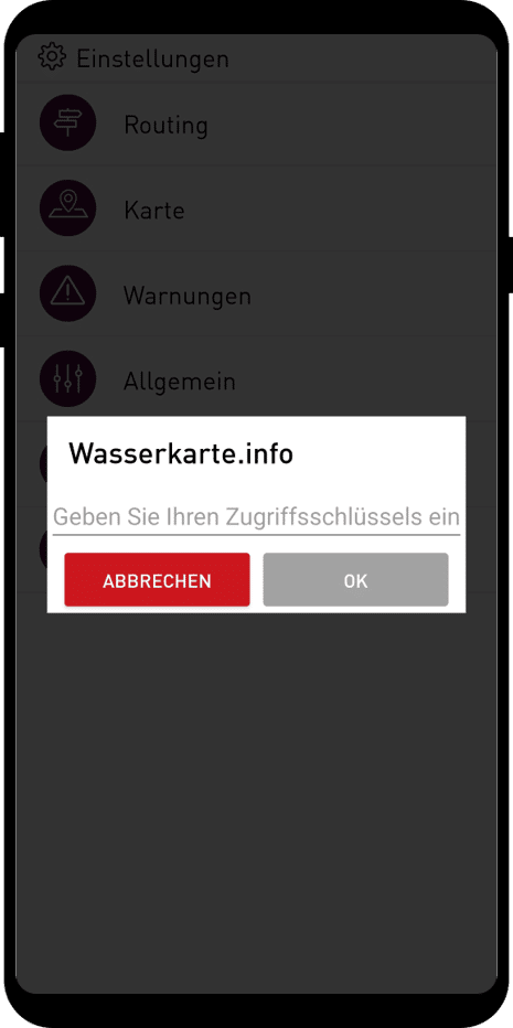
You will be prompted to enter the access key.
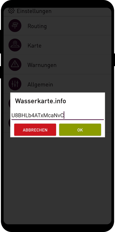
Type the access key with upper and lower case letters.
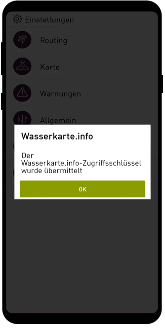
Confirmation successful transmission.
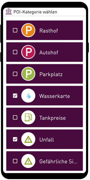
Check under the Map - POI Display settings item whether the Water Map category is checked (green tick).