Forest GPS
GPS Navigation in the forest — difficult without human input
Some navigation destinations are not on public roads but on forest or field paths. Or they are not on any road at all, but in the middle of the terrain. With the GPS navigation app MapTrip you can still reach such destinations. We show how it works.

Mit dem Laden des Videos akzeptieren Sie die Datenschutzerklärung von YouTube.
Mehr erfahren
Navigation software is being used more and more and is increasingly conquering professional fields of application. It is increasingly the case that simple navigation from A to B is no longer enough. In these cases, professional navigation apps have to be used. Use cases can be, for example, timber transports that have to pick up a pile of wood in the middle of the forest. How is the driver supposed to find his destination here? A normal Google Maps navigation does not lead into the forest and it does not know any truck restrictions such as length, width or weight.
Navigation in the forest — difficult without human input
GPS Navigation in the forest is a difficult challenge. In some cases, forest paths are even included in the road maps from TomTom, Here or OpenStreetMap. But whether the line on the map is a robust gravel path or a muddy overgrown trail? No one knows. It would therefore be negligent to entrust a heavy truck to a digital map alone. The risk of getting stuck or of a path being damaged by the heavy vehicles is too great.
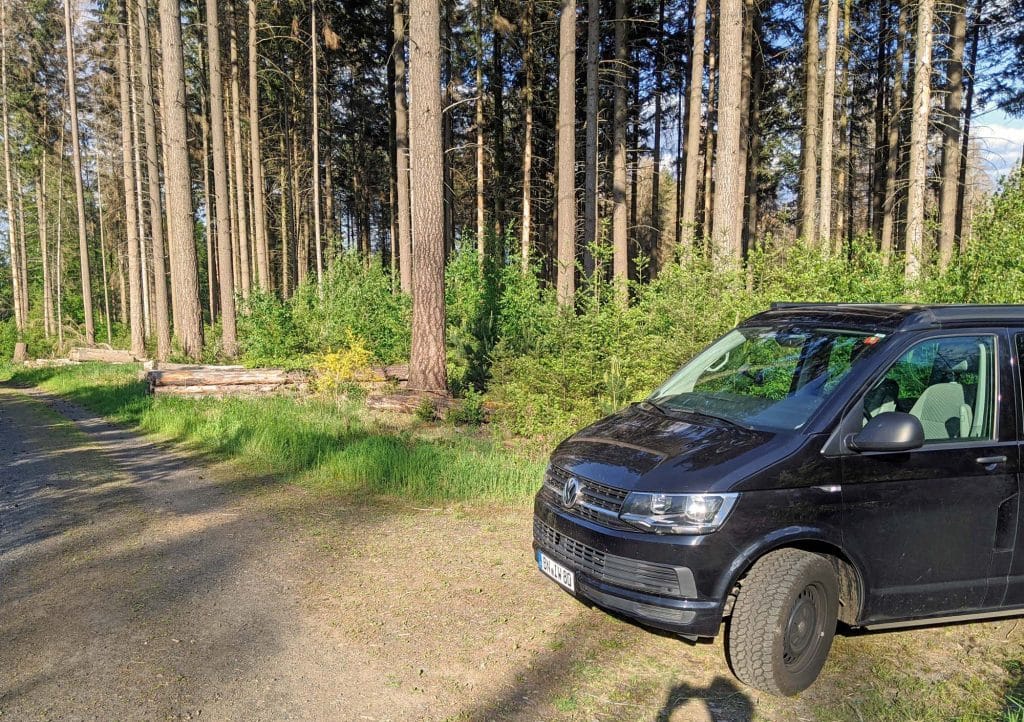
Therefore, to find the best way to a destination in the forest, human local knowledge must be used. The MapTrip Truck navigator offers just the right solution for this with its FollowMe function. Just like in the fairy tale of Hansel and Gretel, MapTrip creates a track from the destination in the forest to the asphalt road. This track is not only used to get out of the forest like in the fairy tale, but also, for later visits, to find back to the destination in the forest.
Truck navigation in the forest — risk: getting stuck
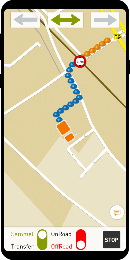
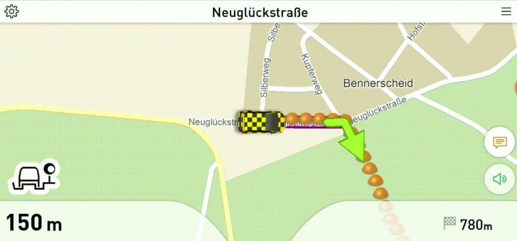
If a truck is to drive to this destination in the forest later, MapTrip first navigates it to the drop-off point on the road like a normal navigation system. Of course, all truck restrictions are taken into account. Once there, MapTrip shows its professional features to full advantage. It continues in the so-called “OffRoad mode”. The driver then only has to follow the given route to safely reach his destination.
So for each destination, a small Hansel and Gretel track (technically a GPS track) is created that leads from the public road to the respective destination.
Navigation to wind turbines
This concept can also be applied to many other application scenarios.
Service personnel who have to drive to wind turbines face similar challenges. How do you find the right way to a windmill in the middle of the countryside?
Farm navigation
Forwarding companies that supply farms have a similar situation. Often the farm is remote and not on the regular road network. Here, too, a lane can be defined that leads from the road to the destination. This ensures that the vehicle reaches its destination safely without getting stuck and without causing damage to the corridor.
Technical implementation
The technical implementation is very simple and is supported by default by MapTrip Truck with FollowMe. Download the navi app here. You can either record the track to a destination with MapTrip in the vehicle or draw it on a map in the internet browser with a mouse click. We’ll show you how to do that in these videos. In the Navi, you only have to call up the track to the respective destination in the FollowMe menu. Done! MapTrip does the rest.